 Not so long ago I noted how strange it is to hear about tragedy in a place I've been on Facebook.
Since I've been to a lot of places on this earth, this seems to happen more and more often.
Not so long ago I posted this:
And now this...
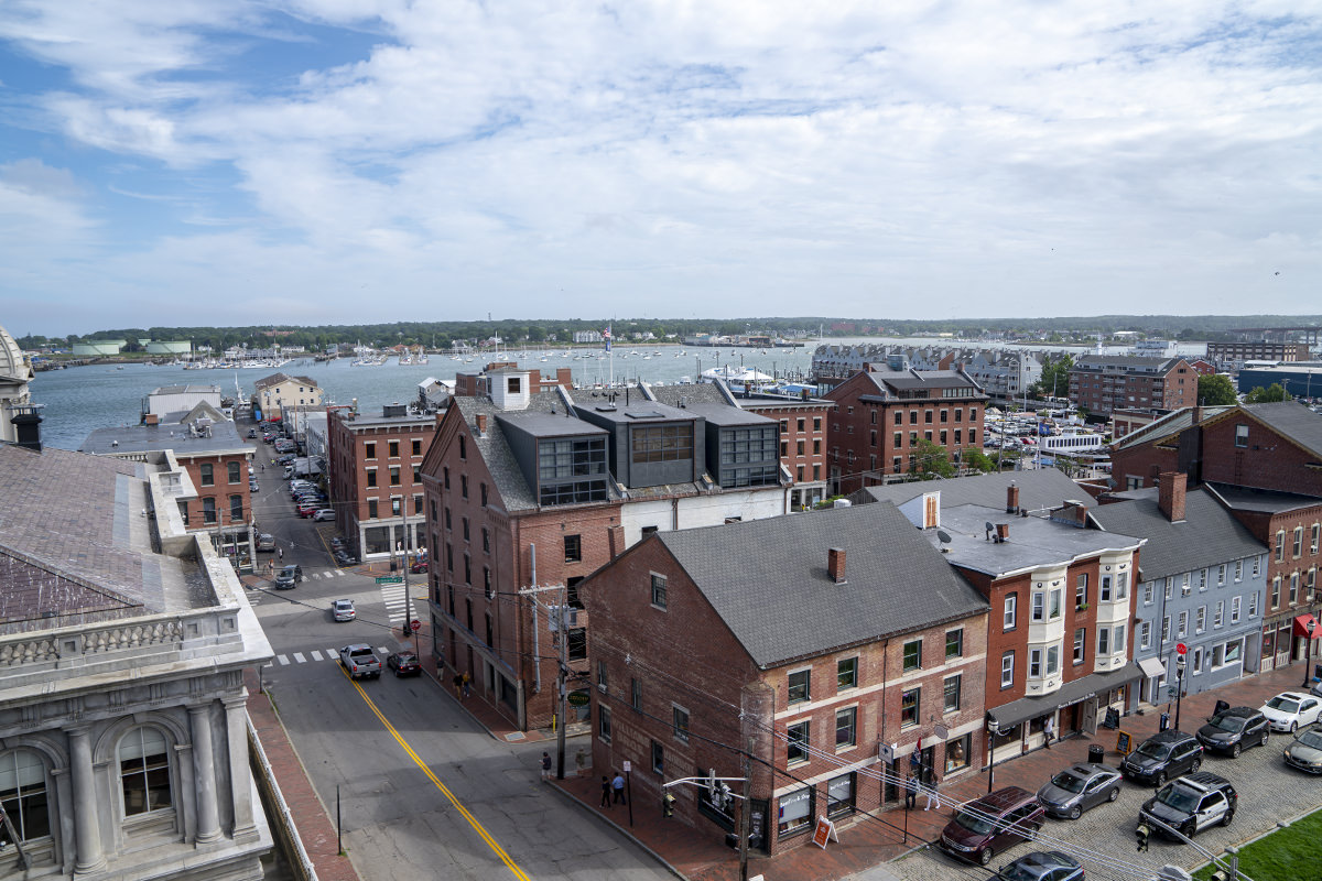
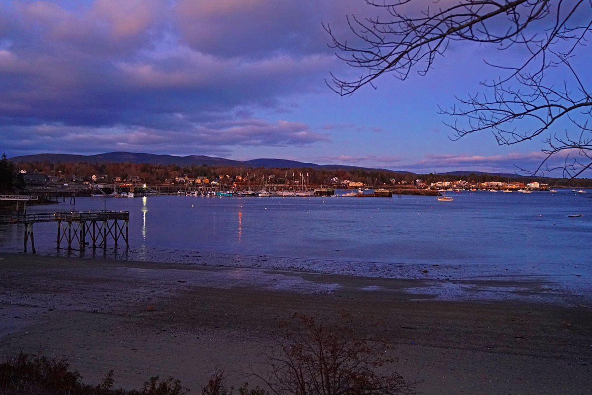
For around a decade I had work taking me to Lisbon, Maine.
Twice a year I would fly into Portland then drive up to the city of Auburn, where I always stayed at the Hilton Garden Inn. It's a nice, reasonably-priced location overlooking the Androscoggin River. The region is home to some very nice people (including those that I worked with), and has interesting eateries across the river I enjoyed like She Doesn't Like Guthries and Pedro O’Hara’s*, a Mexican-Irish restaurant.
Also across the river? The city of Lewiston.
If you've been watching the news since Wednesday night, you know why this has been haunting me.
A single shooter with an assault rifle mass-murdered 18 people in two locations in Lewiston, Maine. Needless to say, I had a rough night followed by two rough days wondering if anybody I know was hurt or killed. As of now I am still wondering because I can't bring myself to email anybody to find out. They have enough to deal with, as the shooter is still at large.
This fucking sucks.
My post about Bangkok was 23 days ago. I didn't even have a month to get over that before this happens. And that's just places I am familiar with. There's loads upon loads upon loads of places going through exactly this kind of thing week by week. And I'm mortified that it's just become background noise to me.
Until it's not in the background. Like Lewiston, Maine.
Lewiston may be the second-largest city in Maine after Portland, but it's not a big city. The first shooting at a children's league bowling alley event is just next door to a restaurant I liked. The second shooting at a cornhole competition even bar & grill is just down the street from a McDonald's that I stopped at for breakfast dozens of times. So, yeah, you might say I'm familiar with the area where the shootings occurred. An area where on Wednesday night people were just living their lives, never knowing that 18 of them would end up dead with even more injured.
Which is all kinds of fucked up. Especially when now-a-days you can't even say you're sad that 18 people were murdered without being told you're "anti-gun" or "woke" or whatever other bullshit labels get hurled by assholes lacking any sense of empathy, decency, or compassion. Something I'm getting used to, despite it never making any sense.
Not that anything surrounding mass-murder ever could.
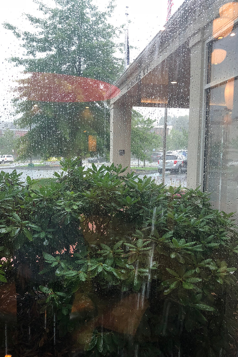
 Breakfast was leftover pizza. Lunch... was also leftover pizza. For dinner there was no more leftovers to be had, so I decided I'd wait 3 or 4 hours, put down my laptop, and venture out for a late supper. But then I heard thunder booming around 4:00, and decided I would rush out to eat before a torrential flood of rain unleashed like it did yesterday.
Dinner was uneventful... thank heavens.
The walk back from dinner? Mostly uneventful...
• There was a scuffle in the parking lot between two guys whom, it would seem, arrived together in the same car. It was more verbal than physical... except for one poorly-timed slap that landed badly and a spit-response. Then one of them ran off while the other got in the car. Apparently to give chase and run him down.
• Whenever I come to the Auburn/Lewiston Area, I note that the Androscoggin River (which divides the two cities) is bordered by "Great Falls Boulevard" on the Auburn side. Problem is... in the years I've been coming here, I've never seen the "Great Falls" be that great. I'm guessing it's great in the Spring, but I'm here in the Summer and Winter when it's just rocks. Today I finally asked about it. "Well, it's not really that great most years any more."
• Today I finally decided to make a quick stop at Veteran's Park next to the above-said-not-so-great-falls. I knew it was here... never stopped. It's dedicated with a marker, which I sadly noted didn't have any women in service on it (sorry for the glare)...
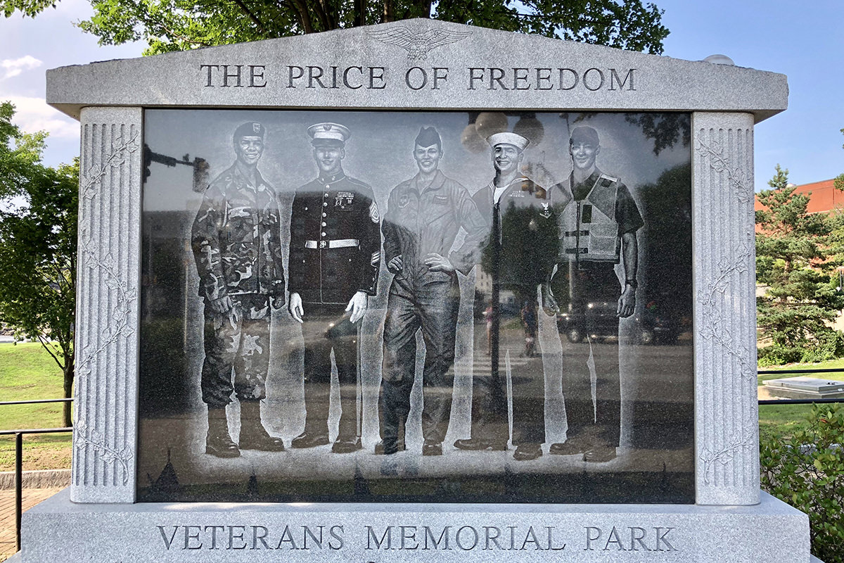
Until I took a closer look(?)...
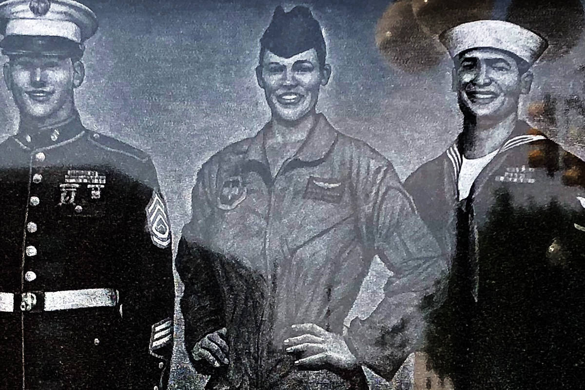
The hands-on-hips should have given her away.
• Other than the odd choice to have a gun firing at a jeep(?) it's actually a nice little park...

In case you are wondering... off to the right there are the Great Falls.
• As I was nearing the end of the bridge, I noticed that there was a Trump Protest going on across the street, almost all of them (I'm guessing) being senior citizens. They were calling for his impeachment...

Maine, like my home state of Washington, is a Blue State. But Androscoggin County, like my home county of Chelan, is a Red County. Meaning more than 50% of the people voting voted for President Trump. Don't know if that would be the case today.
• As I walked up to my hotel, the thunder was growing in intensity, but there was still no rain. As I walked in the sliding doors to the glass-enclosed vestibule, I saw a poor little bird flying back and forth. He was smashing into the windows from one side to the other, and I felt terrible about it. And so... I spent the next five minutes corralling the little fellow until I could shoo him out the front door. Time well spent, even though everybody in the lobby thought I had gone insane.
• When I got back to my hotel room, I noticed that there was a photo of the Great Falls (where there were actually falls) hanging in the bathroom (sorry again for the glare)...
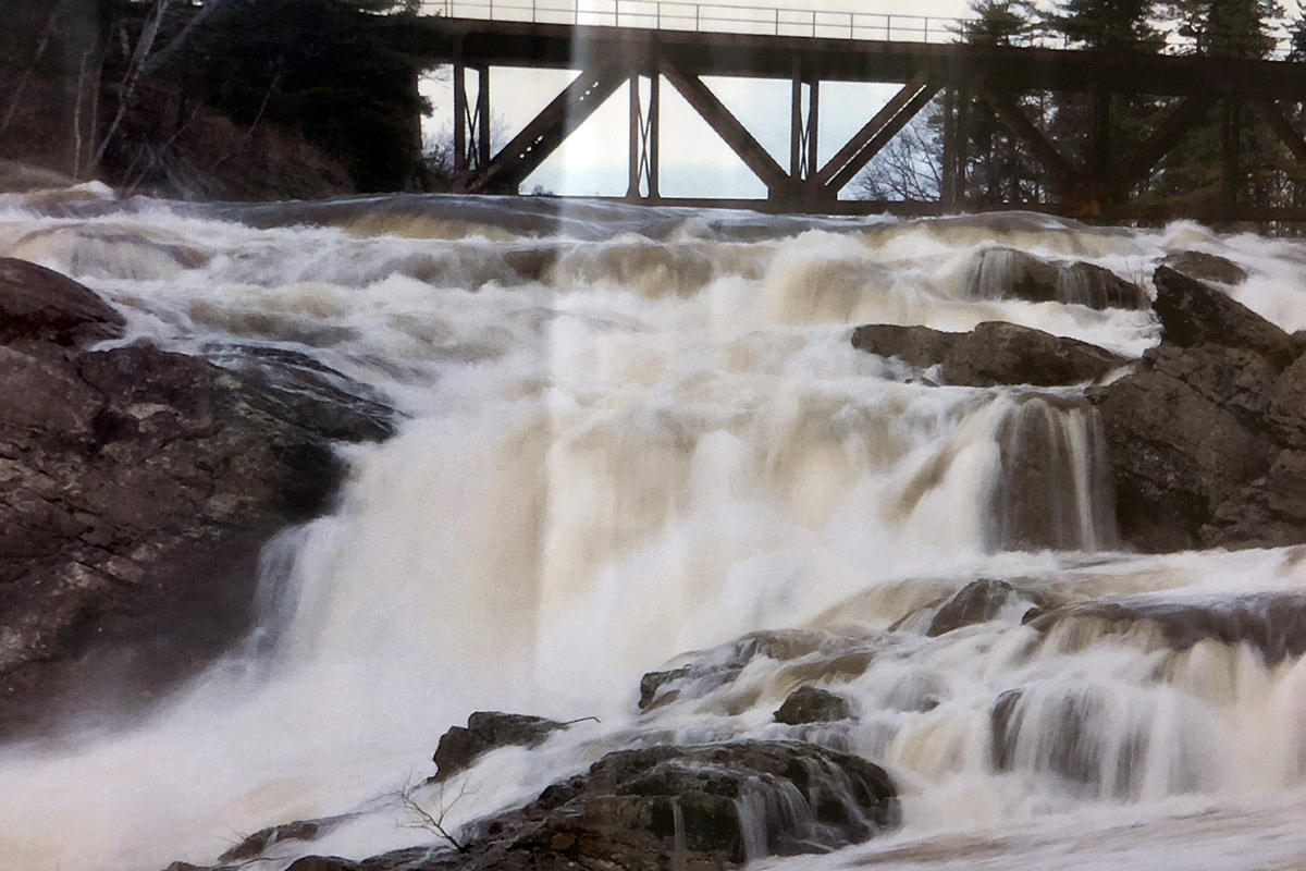
Okay, I have to admit that this does look pretty great!
And thus ends my big day. Tomorrow it's back to work again.
 When I finished work at around 8:30am (which made it a 13-1/2 hour shift) I went straight back to the hotel so I could try and get some sleep after 23 hours of being awake. I was hoping for more than six hours, but I'll take what I can get.
And what I wanted to get at that point? Food.
When I went to bed, it had just started to sprinkle. When I went down to the lobby to drive somewhere to eat though? Rainageddon. My first clue was when the hotel staff was furiously attempting to clean up the gallons of water that had poured into the building...
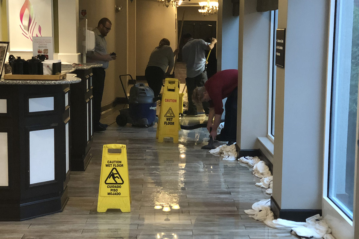
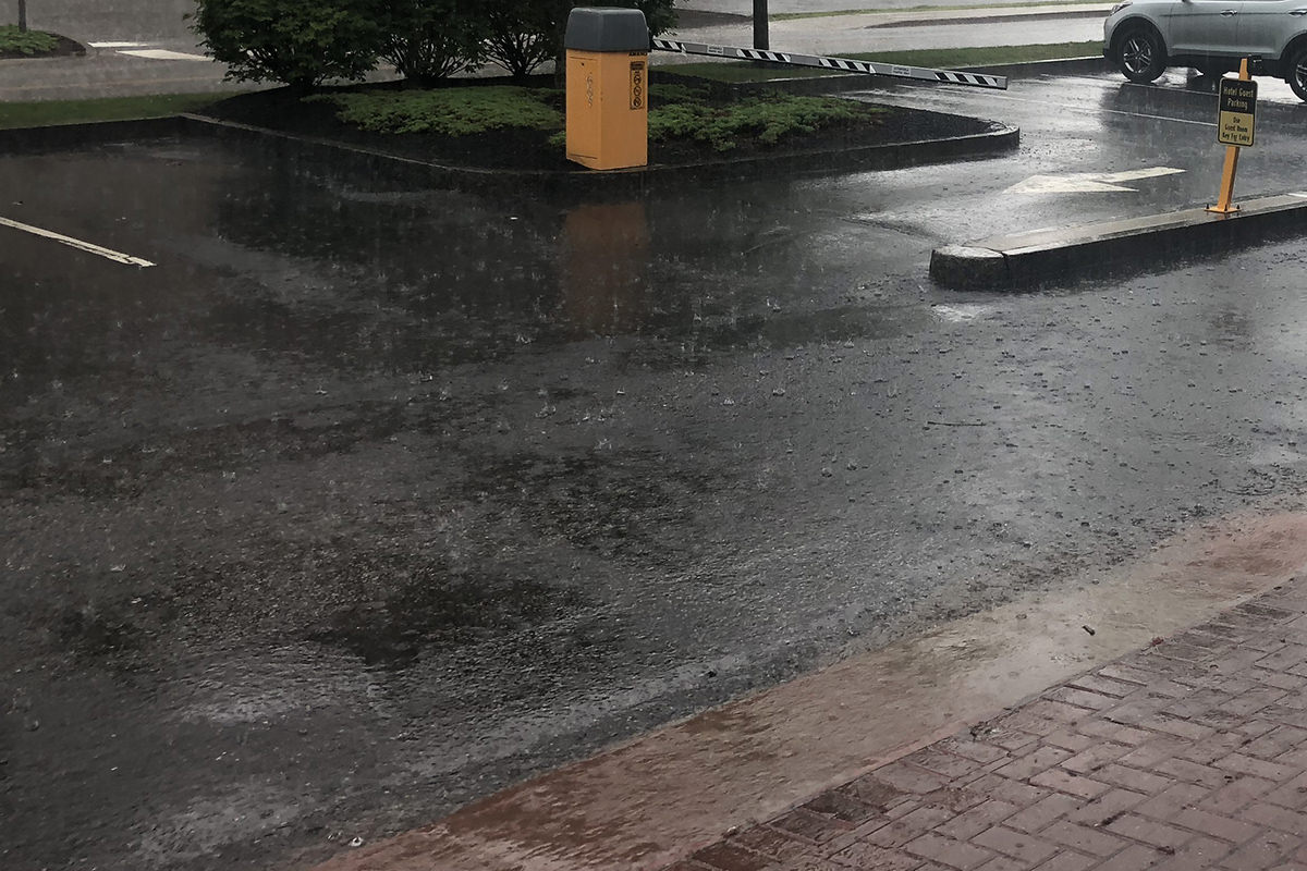
I was then told that many roads were closed because they were flooded... and the rain was so bad that part of the roof of the local hospital had collapsed. And so... I decided to walk to a local eatery rather than risk being out on the roads. Problem is, I didn't have a raincoat.
And so I made one by clipping a plastic bag into a long-sleeve shirt...
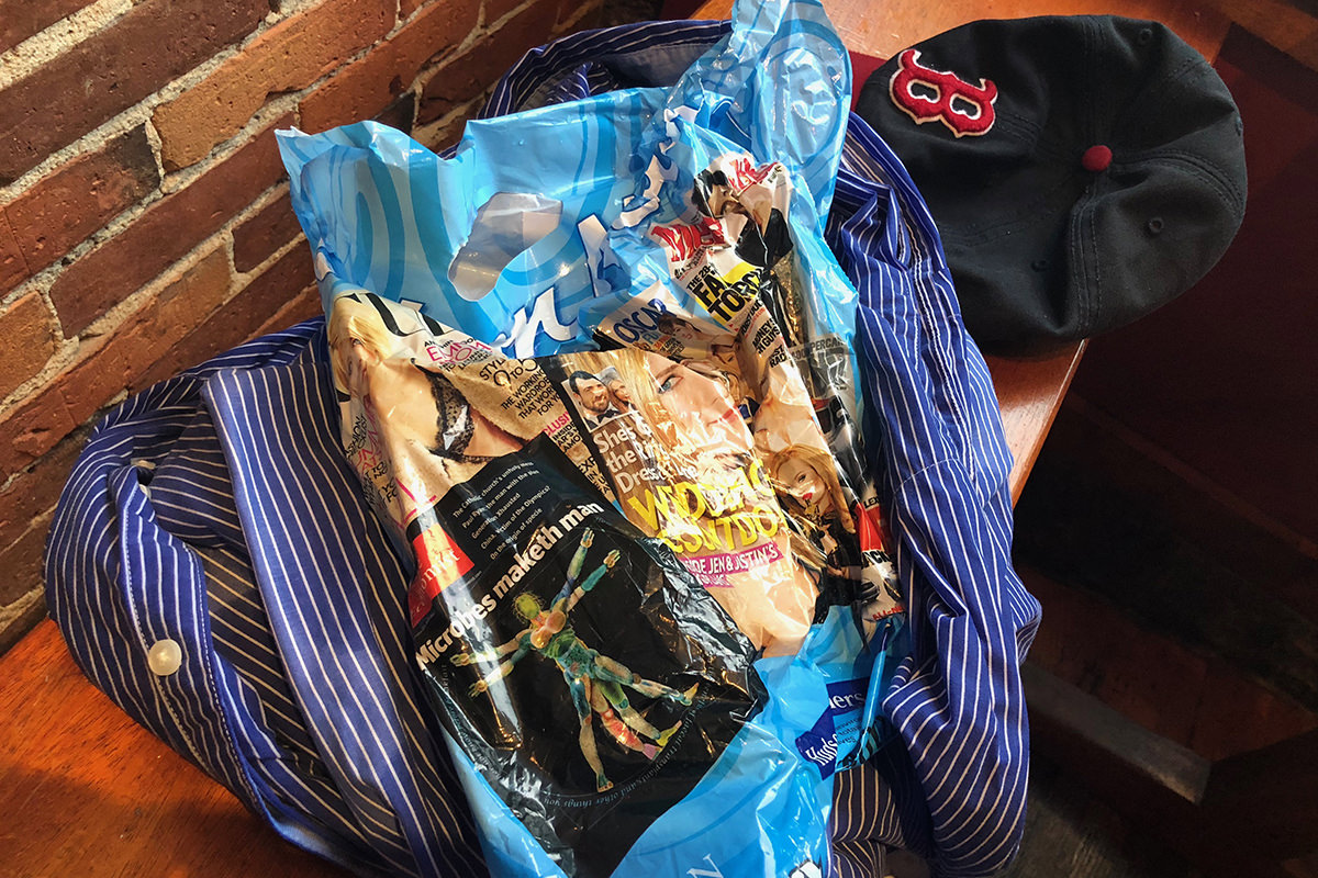
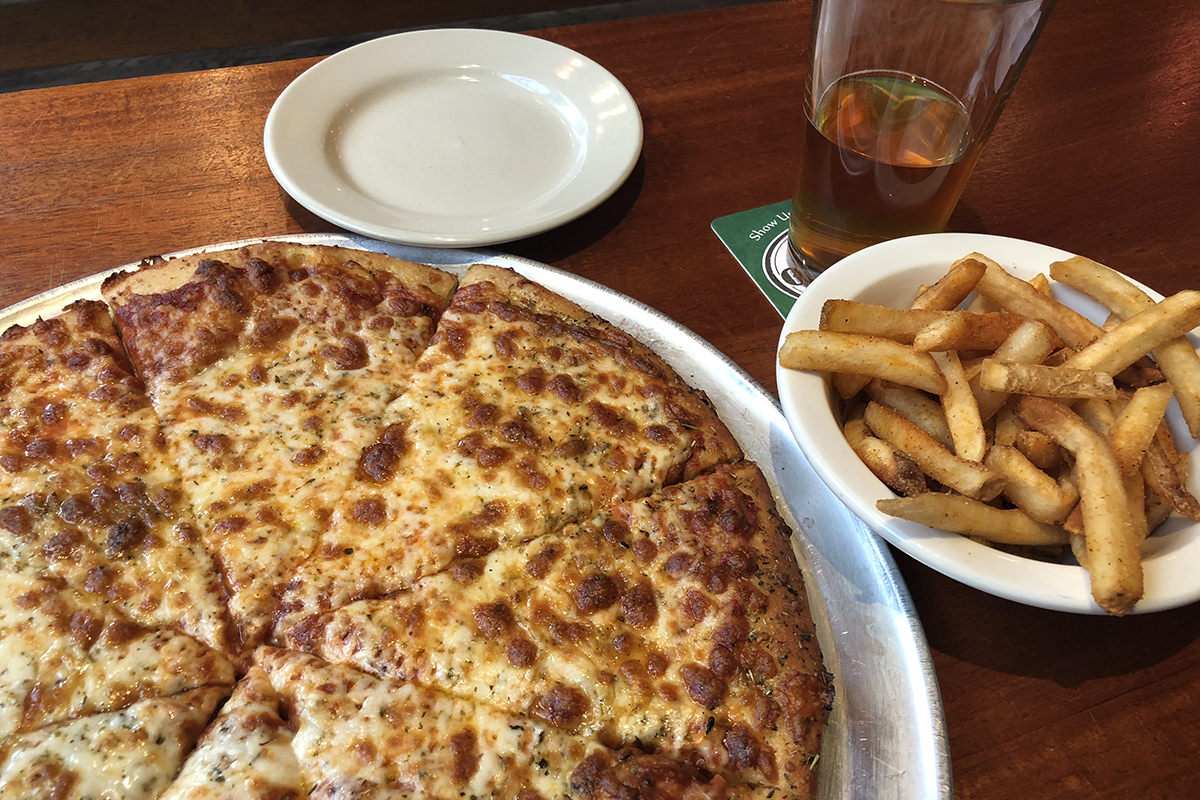
That coupled with my faithful Boston Red Sox hat didn't do much to keep me from getting soaked, but it was better than nothing. Totally worth it... because pizza and beer...
By the time I had finished eating, it was still raining... but not nearly as much. And yet the damage had been done. My clothes were completely soaked...
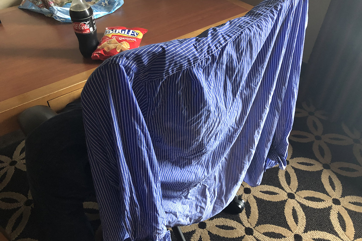
I guess dinner will be leftover pizza and a Coke Zero from the vending machine followed by Bugles for dessert, because I ain't going back out in this.
 It's 11:59pm and I've been on-site for a job for five hours. There's at least seven hours left to go... probably more... and my brain is starting to feel mooshy. If only I had taken a nap when I got into town instead of doing silly things like eat, unpack, check email, and spend time on Facebook. But, alas, it was my understanding that I would be finding out when work starts at 7:00 rather than actually starting work at 7:00, so my bad.
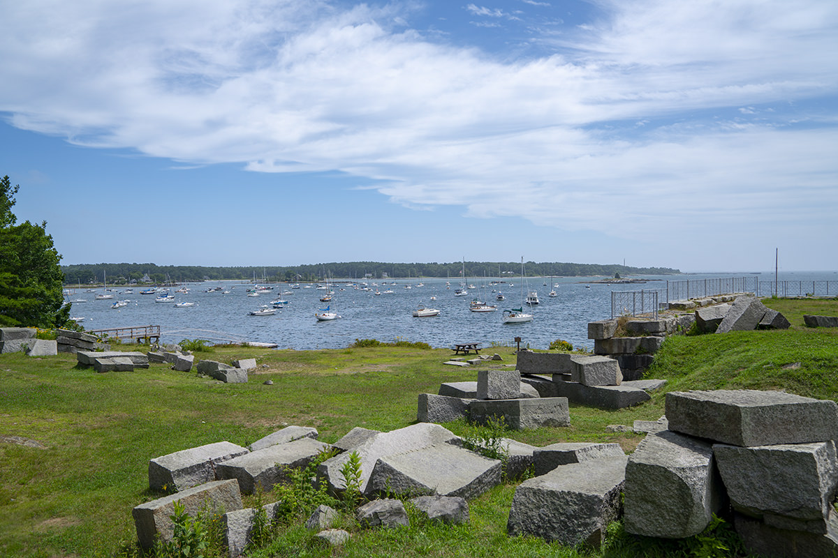
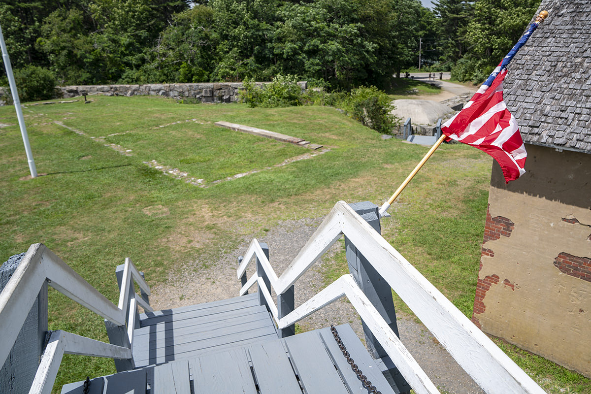
On the drive up to Maine, I stopped along the way to visit with an online friend I've never met in person before. He lives in a beautiful region of the state called Kittery Point, which is home to Fort McClary. The site is a bit confusing for a "fort" as there are no walls. Just a kind of hexagonal building overlooking the water...
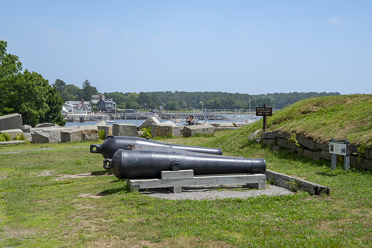
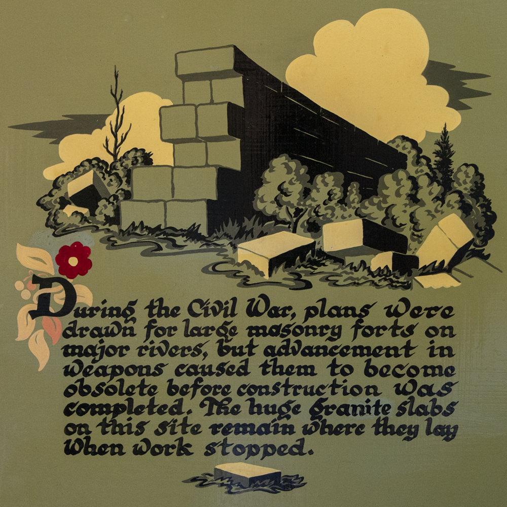
Once you get inside, however, all is made clear. There's a sign saying that the fort was never completed because an advancement in weaponry made it obsolete, and the granite blocks for constructing it were just left where they lay when work stopped...
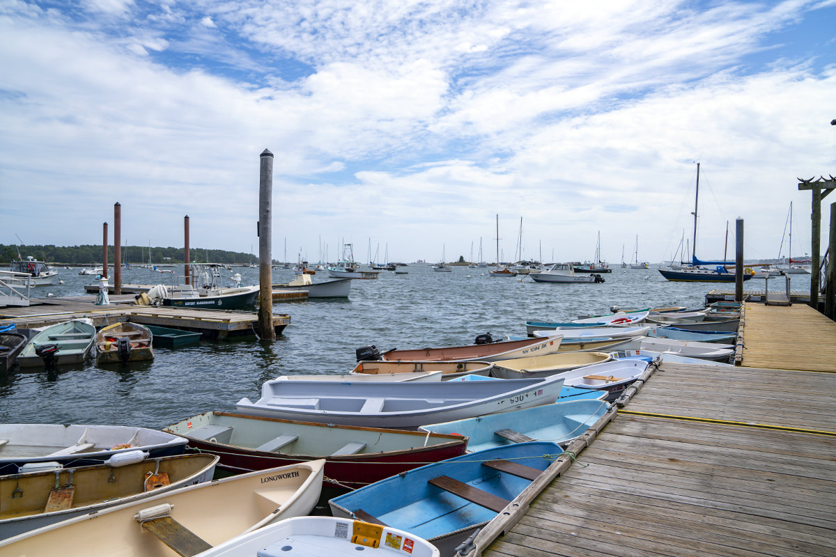
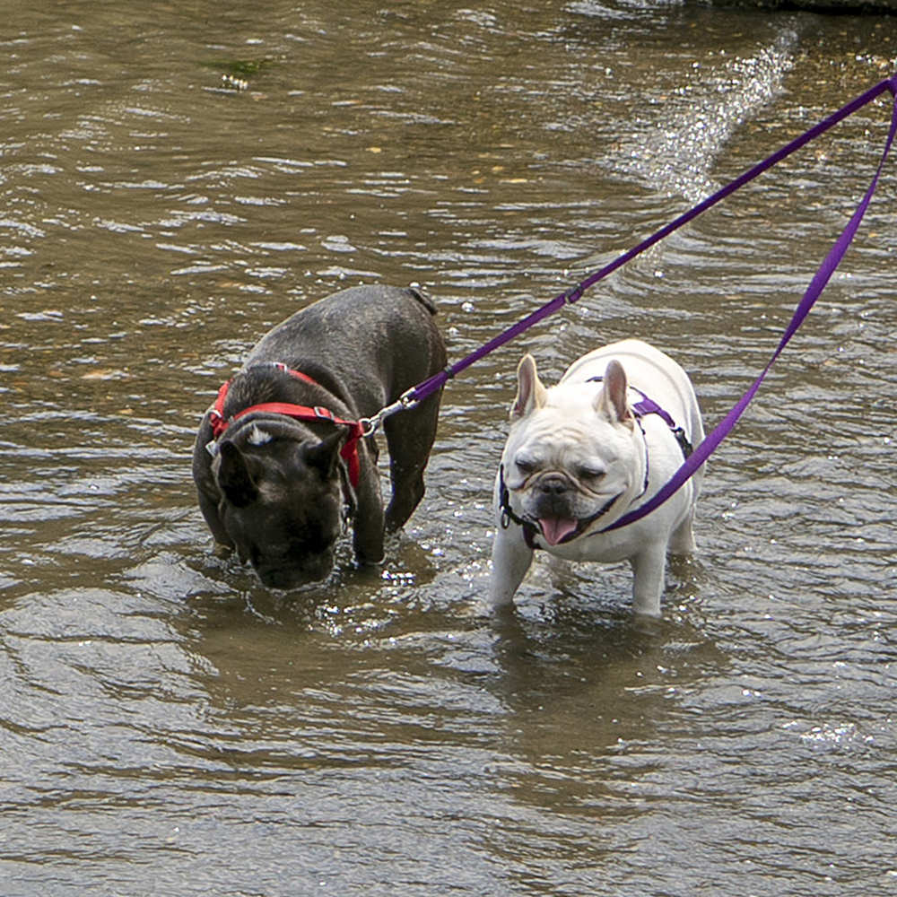
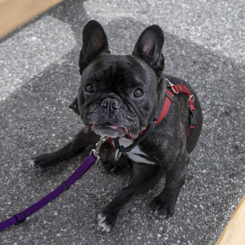
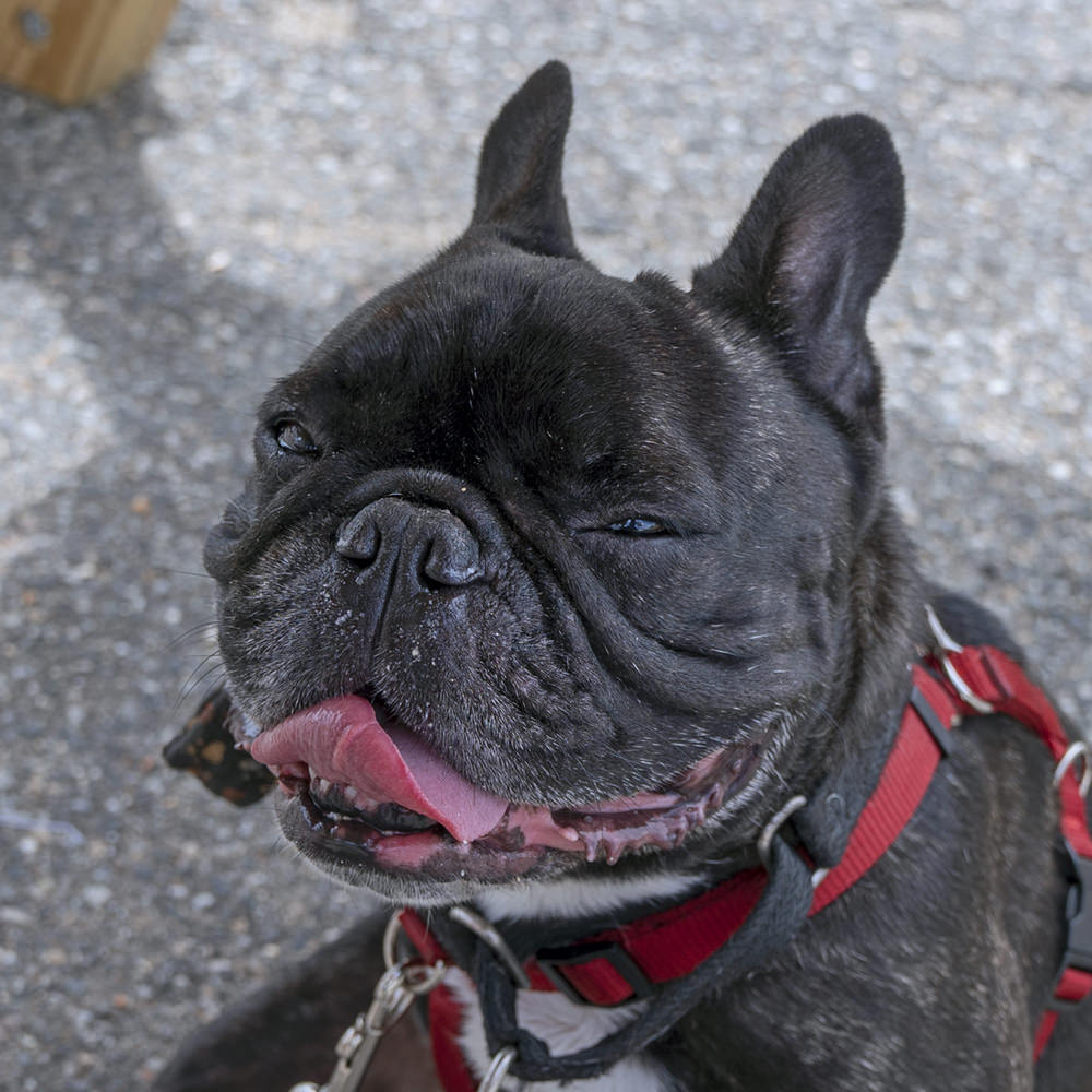
After meeting up with my friend, we walked with his dogs down to the waterfront on a beautiful Maine day...
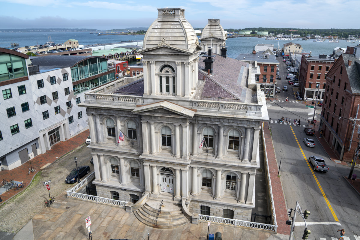
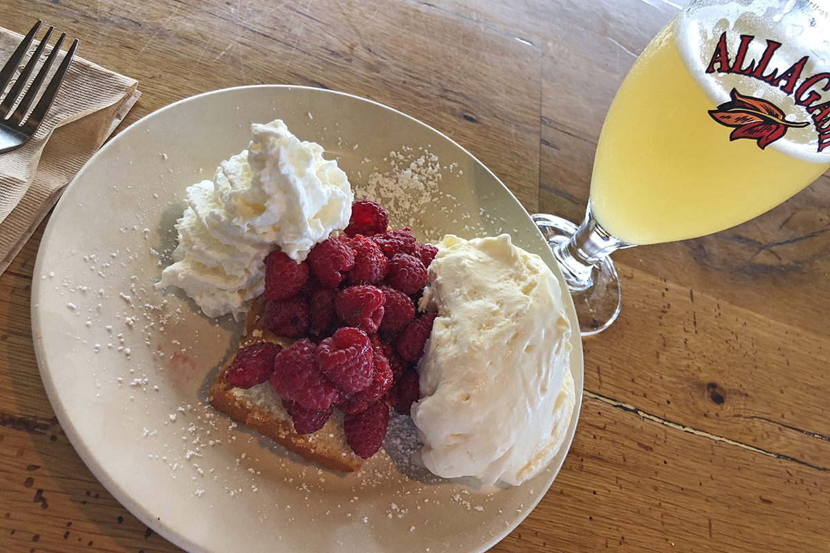
I always make time to stop in Portland for a glass of Allagash White (one of my favorite beers on earth) and whatever seasonal dessert is local. I always park across from the Old Customs House, but never thought to stick my camera out of the parking garage until this trip...
My favorite summertime deserts here are made with Maine blueberries (seriously nothing else like them), but this time I happened onto Maine raspberry season, which is so short that I'd never had them before. Delicious, as I knew they would be...
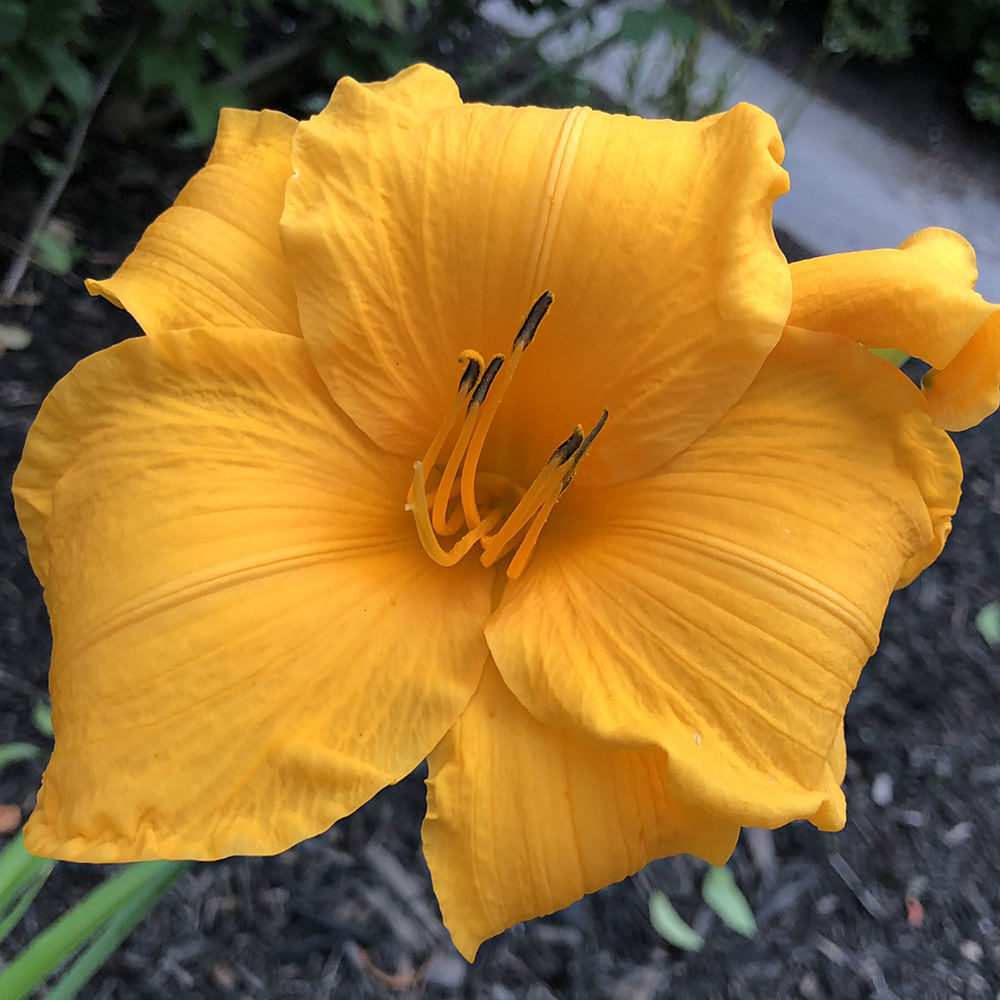
On the way to work, I saw that Maine was still in prime blooming season, even though it's just starting to end back home...
And now? Back to work I go...
 If you ever visit Acadia and Mount Desert Island, you're bound to run across the sprawling campus of "The Jackson Laboratory." This massive facility employs 1,300 people and is dedicated to "...investigating the genetic basis of cancer, diabetes, Alzheimer's and many other human diseases and disorders" (according to their website).
What's weird is... I had actually heard of them prior to my visit.
People for the Ethical Treatment of Animals (PeTA) waged a war on them earlier this year for their (mis)treatment of laboratory mice (Jackson Laboratory reportedly breeds and ships over two million mice per year to other laboratories around the world... their website has a whole section devoted to it). The conflict ended up in my newsfeed more than a couple times. PeTA alleges that a whistleblower came to them with information on how the mice were being tortured and killed. Jackon Laboratory denies it all. Lather, rinse, repeat.
It's a tough argument to weigh in on.
On one hand, whatever we can do to eliminate things like cancer and Alzheimers sooner rather than later is a very good thing.
The the other hand... torturing animals to get there is a horrendous thing.
If I had Alzheimer's and was told the cure would involve thousands... tens of thousands... hundreds of thousands... of mice being forced to live a life of torture and pain, would I take them up on it? I honestly don't know. I would like to think not.
But if somebody I loved had Alzheimer's?
 That was one busy weekend.
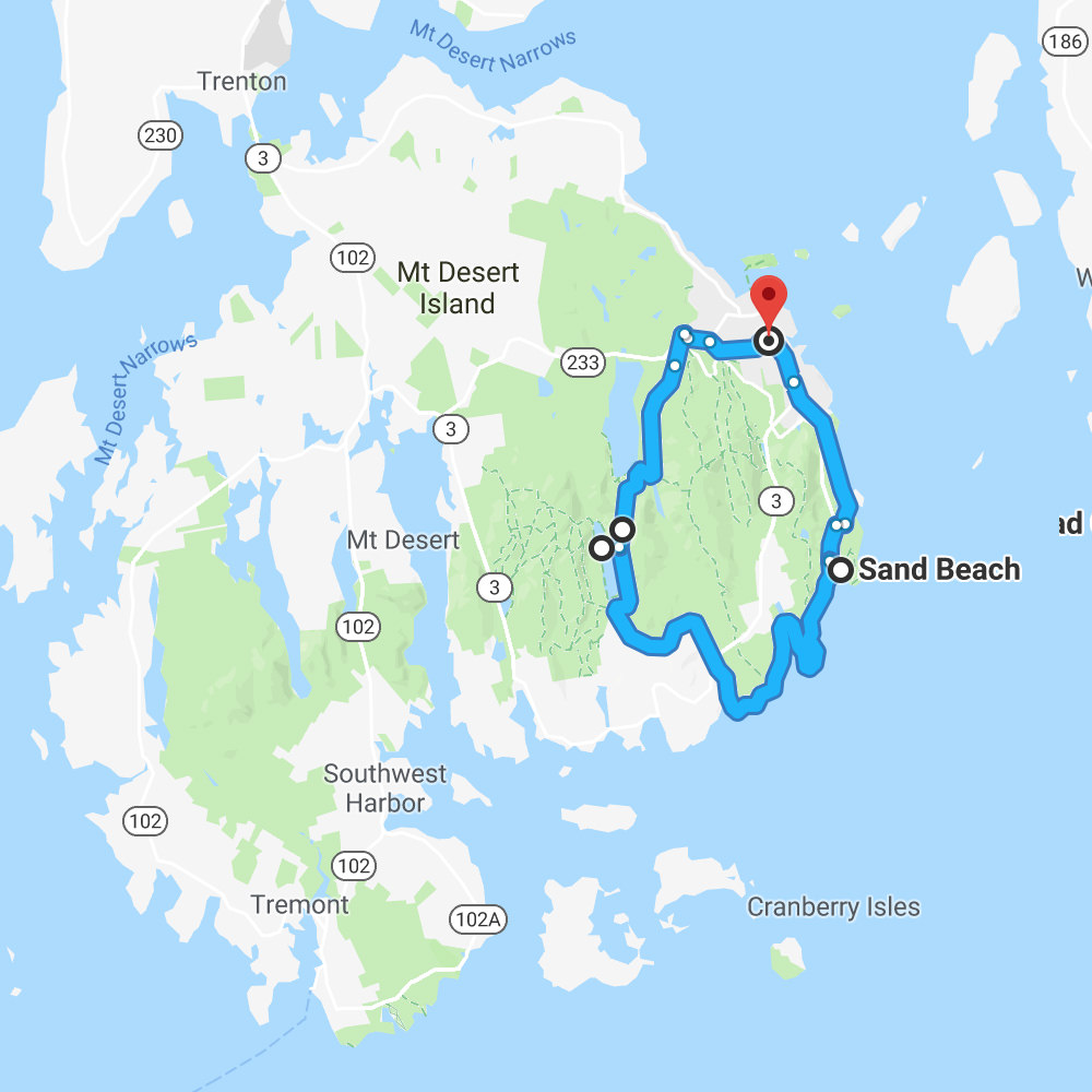
The main road through Acadia National Park is "Park Loop Road"... which is one-way for a big chunk. This can make planning a travel itinerary tricky because there's no backtracking if you miss a turn or blow past an exit.
Fortunately Google Maps makes it easy to enter a bunch of stops then rearrange them until you have a simple plan instead of having to take multiple loops around the island trying to see everything. With the exception of not finding "Boulder Beach" the first time around, Acadia was relatively painless to navigate.
And now, because I am definitely returning one day, I'm going to post my maps so I can remember how I saw what I saw...
FRIDAY...
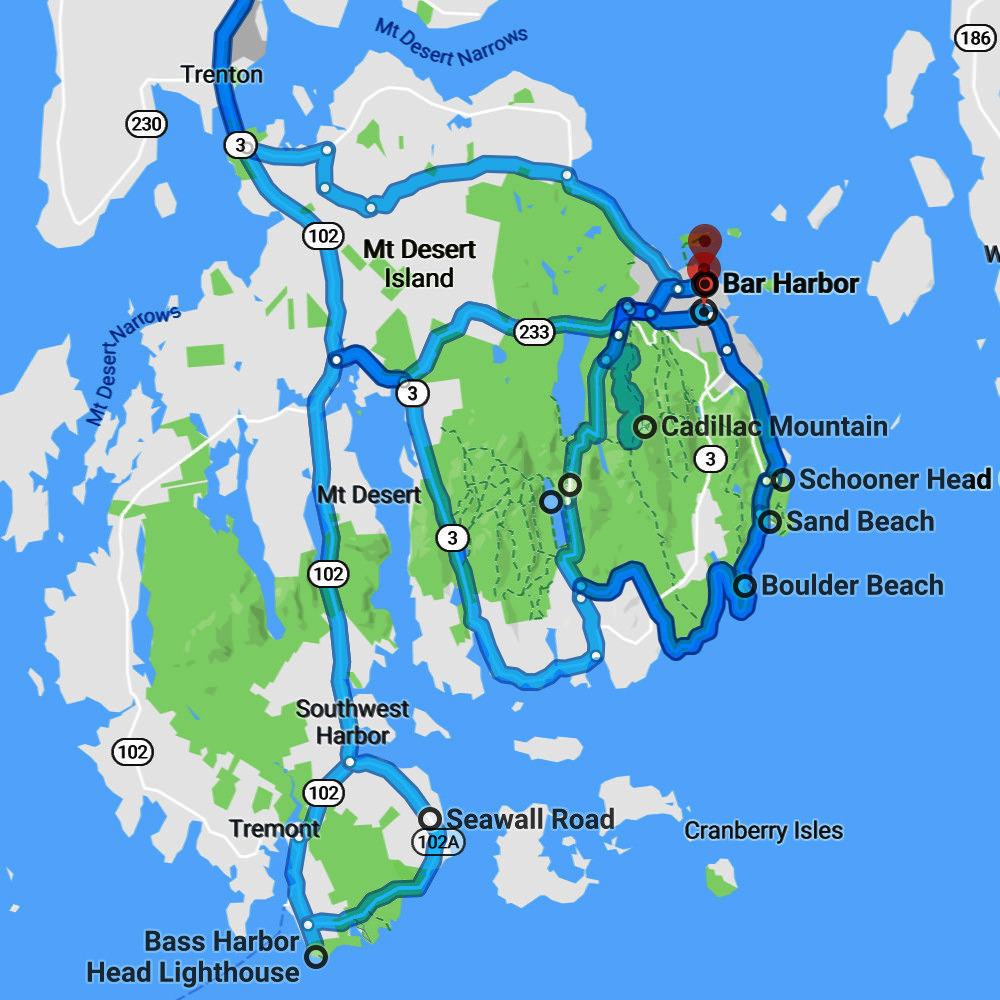
Portland to Bar Harbor to Bass Harbor Sunset...
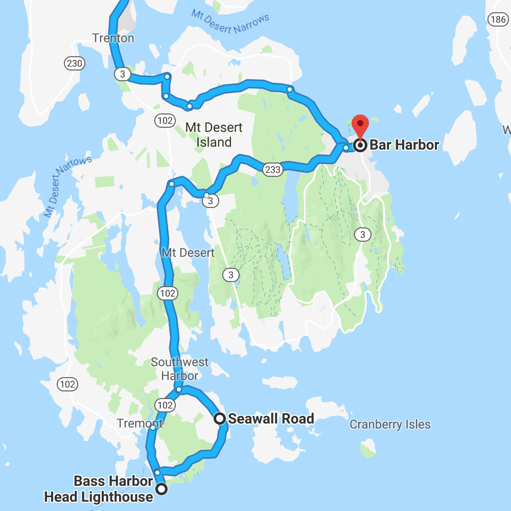
SATURDAY...
Bar Harbor to Sand Beach to Jordan Pond to Bubble Mountains...
SUNDAY...
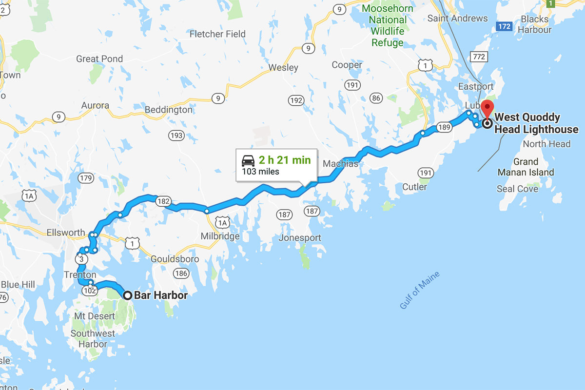
Bar Harbor to West Quoddy Head Light...
MONDAY...
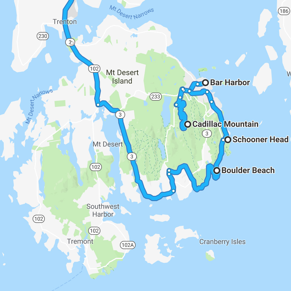
Bar Harbor to Cadillac Mountain Sunrise to Schooner Head to Thunder Hole to Boulder Beach to Somesville to Portland...
And that's that.
Interesting to note... when I line up all the maps and multiply them all together, you can see how I hit most every major road in the park... with the exception of Route 102 up the West Coast and a couple chunks of Route 3 in spots. Not sure what I missed, but it might be worth finding out for next time...
Thanks, Google Maps!
Today I was going to sleep in and get some work done before heading South to my job-site. But when the heavy rains blew my schedule apart yesterday, I had to move all the things I had planned for then to today. Everything worked out pretty great though, because the weather was beautiful.
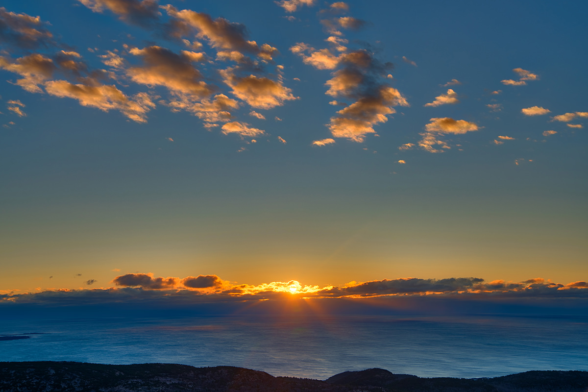
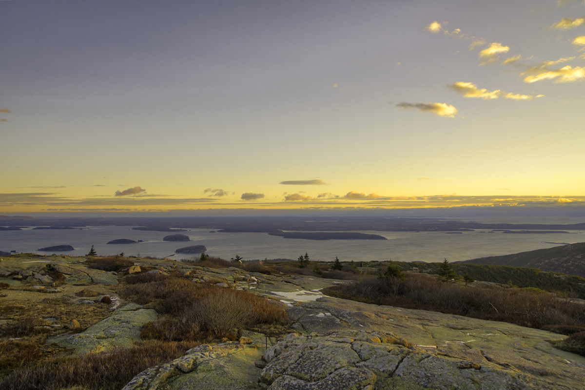
My day started with a 5:30 wakeup and a drive up Cadillac Mountain. Six months out of the year (including this month) this is the place which sees the first rays of run in the whole USA. And so, if you're in the USA... there's a pretty good chance I saw the sunrise before you did!
The park has been surprisingly vacant since I got here. I rarely see other people. But there was quite a crowd for the sunrise show... 25... maybe 30 people. And here's the bizarre part. Many of them... at least half... left the minute the clouds started to glow like this...
Now, granted, it was bitter, freezing, awful cold up there. I was numb from my head to my toes despite wearing two shirts, a hoodie, and a winter jacket. It was so bad that I couldn't even feel my fingers after ten minutes.
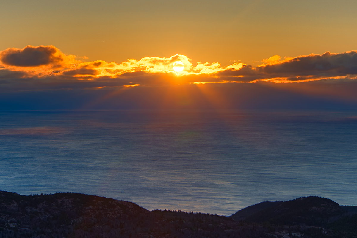
And yet... what's the point in getting up early and driving up a mountain to see the sunrise if you don't wait for the sun to actually... uhhh... rise? That's when the good stuff starts to happen. We had cool clouds that obscured the sun nicely, so the sky was changing from minute to minute as the sun made its journey. Here we are as the clouds start to catch on fire...
And here we are when the sun had finally hit the sky. Amazing. But most people missed it, because there were only about four people around me by this point...
SOLAR-FUN-TIME-SUPER-SUN-ZOOM-CAM IMAGE...
As if that wasn't enough awesomeness, the islands off-shore looked fantastic as they all lit up with the rising sun...
And yet... by this point, there was only me and one other person to see it. What a shame.
After driving back down Cadillac Mountain, I headed to Schooner Head Overlook. There is a cool feature called "Anemone Cave" down below, but it's a sea cave and can only be accessed at low tide. Since that was at 5:30am this morning, and it was already 8:00 by the time I arrived, that experience was not meant to be. But I did get to see some cool (and, assumably, very expensive) houses. The one of the right is almost invisible because it looks like rocks...

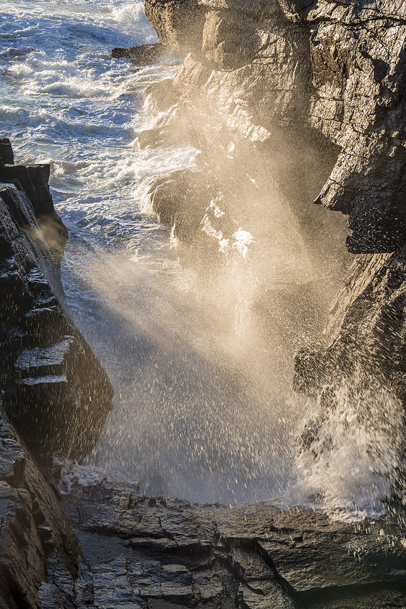
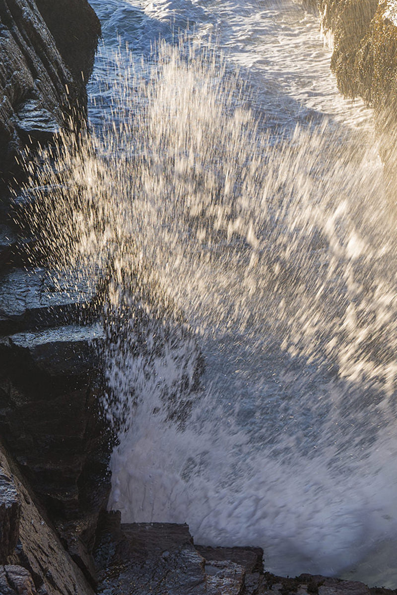
A quick drive later and I was at "Thunder Hole." This is a really cool coastal feature that is more impressive the less close you get to it.
Let me explain...
There's a narrow inlet in the rocks where waves crash in, causing a huge plume of water and a crashing noise that sounds like thunder. Apparently, the plume can go up to 40-feet high. But, at that volume of water, the park closes off access so you have to watch (and listen) from afar. They close off access in four stages depending on how much water is heading in. When I visited, stage one was closed off, so I had to watch from up at stage two...
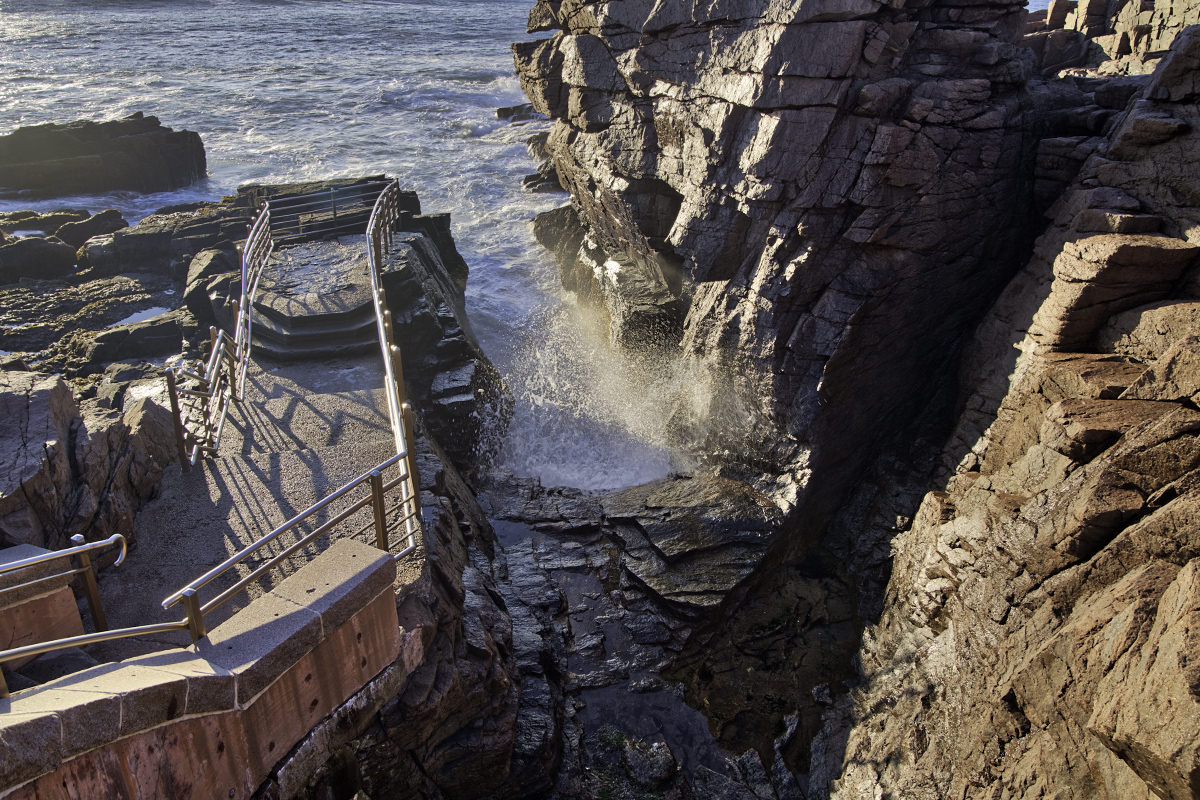
Alas, stage two doesn't sound a lot like thunder... but it's still fun to look at...
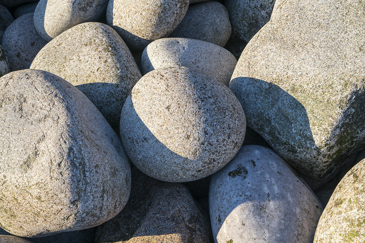
My last stop within Acadia National Park was "Boulder Beach."
I actually tried to find it when I was here on Saturday, but couldn't. Last night I read up on it and found that I just hadn't gone far enough down the path (the lovely, lovely pine-tree path that smells incredible!). You have to keep walking until you spot it from the trail like this...
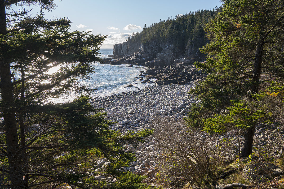
Now, admittedly, I was a bit disappointed when I saw this. "It's just a bunch of rocks!" I said.
Turns out that to truly appreciate this for the marvel of nature it is, you have to climb down and make your way across the large rocky stones at see it up close and personal.
All the stones have been worn smooth over the eons by the pounding surf, then deposited on the shore...
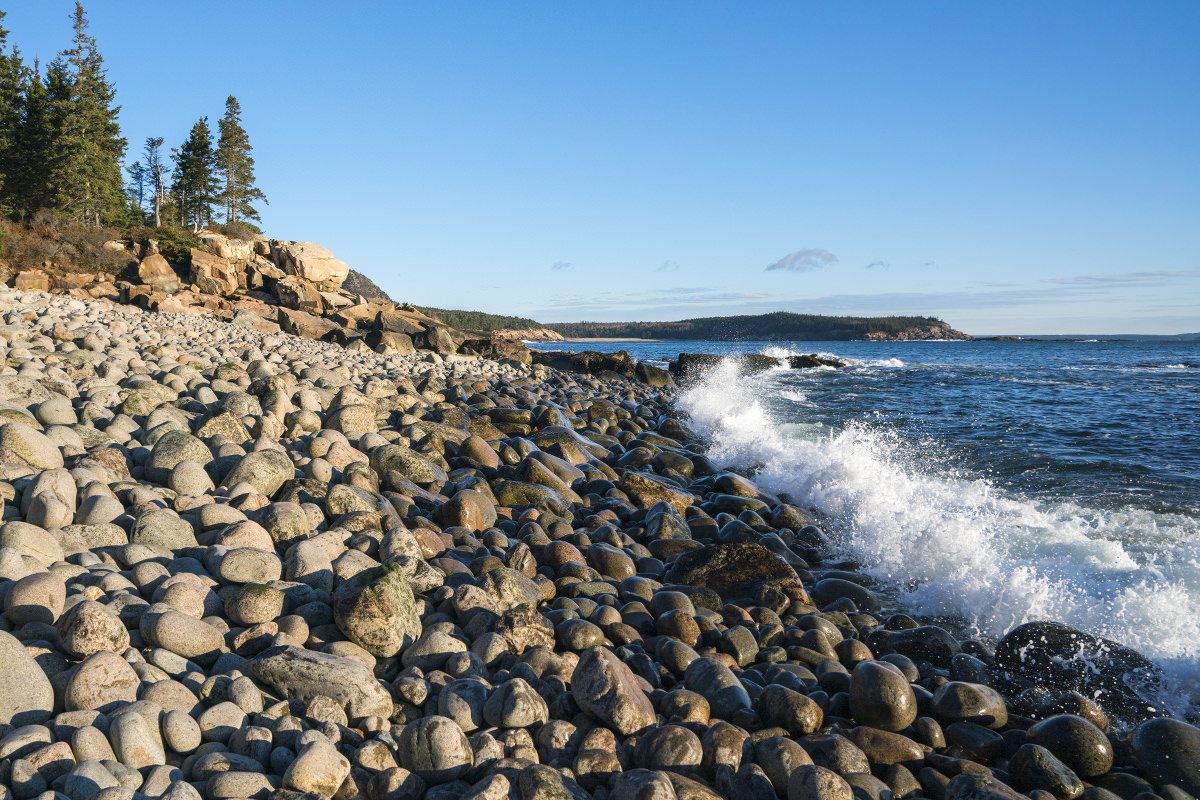
It's looks like something out of the movie Alien. Smooth egg-shaped stones on both directions...
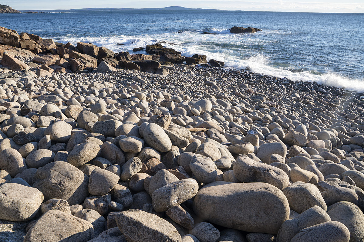
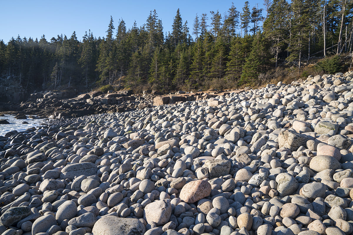
Many of them are bizarrely smooth and egg-shaped... or even round. Amazing, amazing stuff. And impossible to wrap your head around how many thousands of years it took for them to turn out like this...
Almost as cool as how it looks? How it sounds. Every time the waves recede, the rocks are sucked out with it... then rolled back onto shore. If you turn the volume way up when you watch the movie I recorded below, you can kind of get an idea how awesome it sounds in person. It's very deep... kind of like the thunder I was expecting to hear at Thunder Hole...
And... the end.
The bad news? My time at Acadia National Park had come to a close. The good news is that I get to check off another park from my Big List of National Parks I've Visited! Sixteen down... 43 to go!
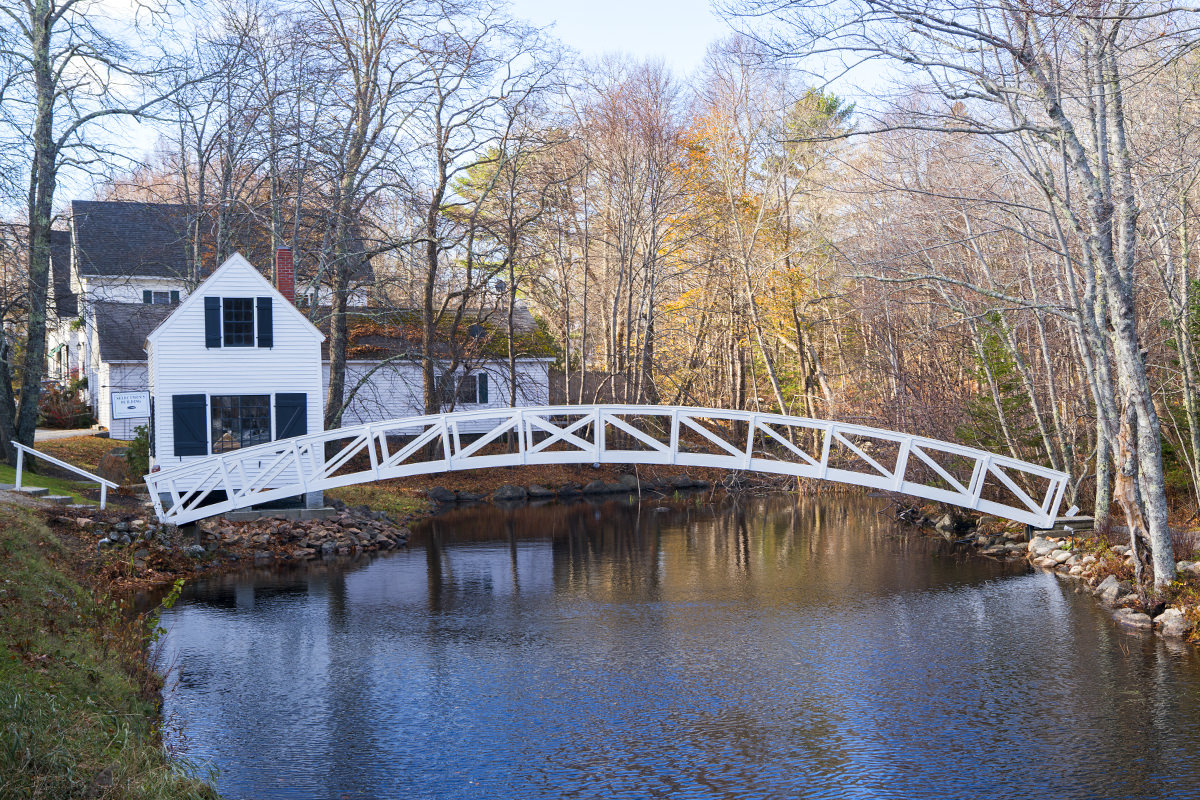
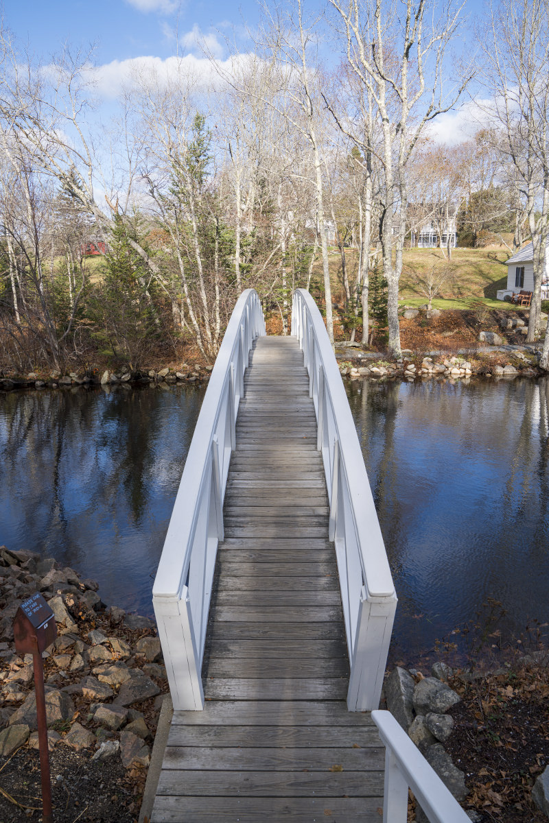
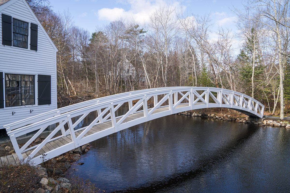
After packing up my stuff and checking out of my hotel, I stopped by Somesville on my way off Mount Desert Island. It's home to a pretty wooden bridge that's a popular tourist spot...
Now that's really the end because I've got work waiting for me.
Since this was a work trip and my work is indoors, I didn't really equip myself for outdoor adventures. So when I woke up to pouring rain and realized neither my jacket nor my hoodie were waterproof, hiking in Acadia had to be scrapped and I needed new plans for my Sunday.
I didn't want to stay in my room all day so I decided to drive somewhere interesting. But where? Someplace far away so most of my time would be in a dry car instead of the wet outdoors. At first I thought I'd head inland in hopes of better weather. But the weather service said it was raining there as well. Bar Harbor is the furthest north I've been in Maine... so maybe up the coast? I decided to Google the area, which is known collectively as "Down-East" (or "Downeast") to see what's there.
And that's when I saw it.
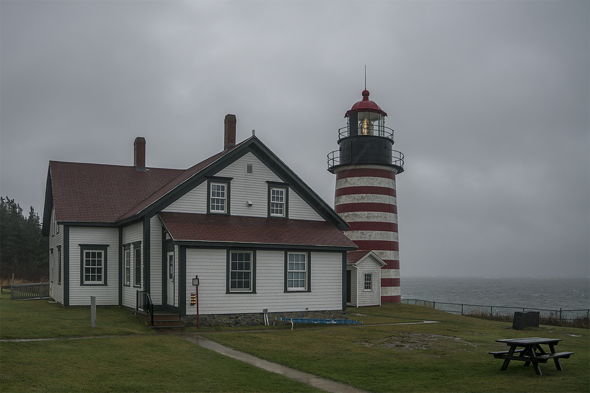
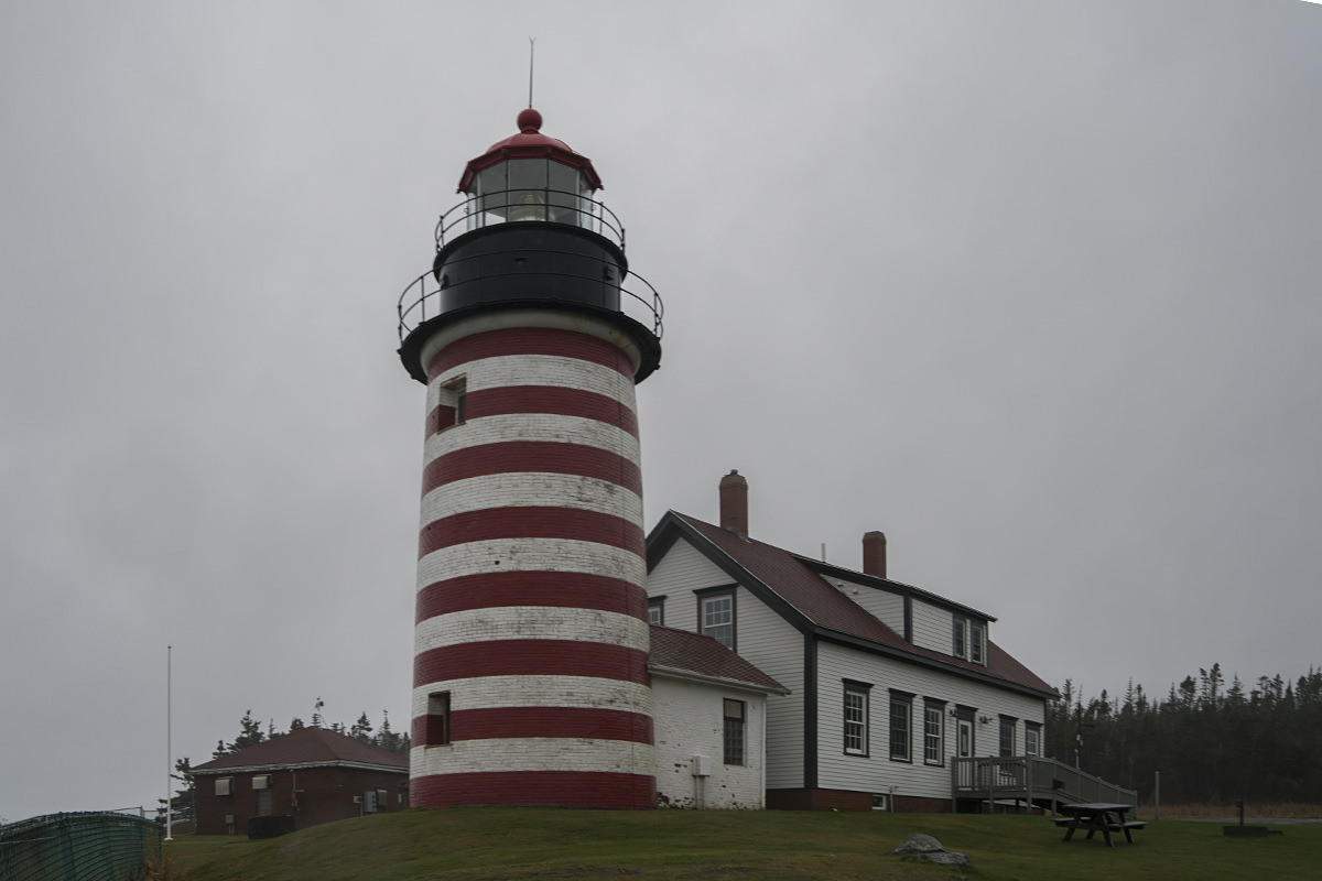
Two hours and twenty-one minutes north of here is the USA's easternmost point... West Quoddy Head Light (lighthouse). I've already been to the southernmost point of the Continental USA in Key West, Florida, so why not?
I decided to head UP* the DOWNeast to go to the EASTern most point in WEST Quoddy.
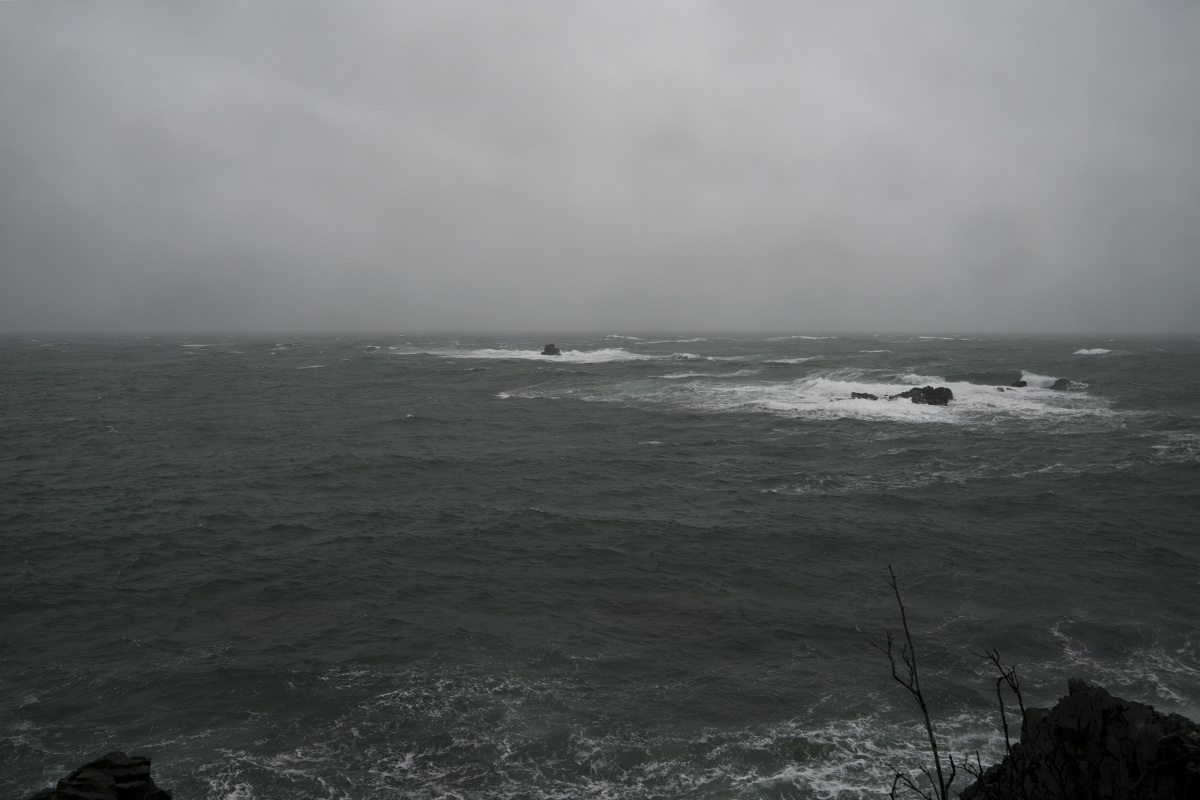
That's more than a little confusing, but okay. Off I went. The drive isn't that bad, but the gusting wind and driving rain meant it was slow-going. And when I finally got to West Quoddy Head Light? I don't know what "gale force winds" means**, but this is probably what they are talking about. There were times I was almost blown over while trying to walk it was so bad. The rain was relentless, which meant I had to seek cover to wipe off my camera lens ever 60 seconds. Plus? The sun was blotted out, so it was dark.
All in all? Probably not the greatest idea I've ever had, but I made it. Achievement unlocked. Apologies for the blurry photos but... rain and all that...
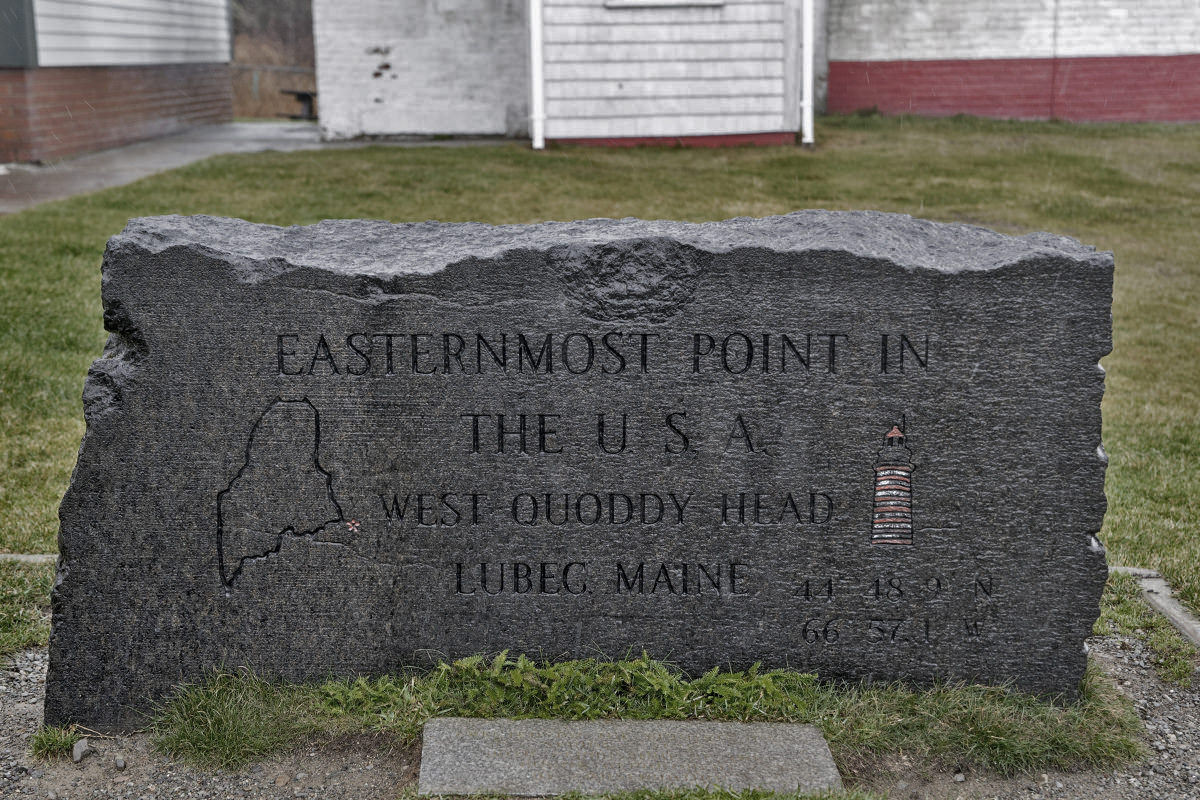
In case there was any doubt as to your standing in the easternmost point in the USA, they have a gravestone(?!) to make it official...
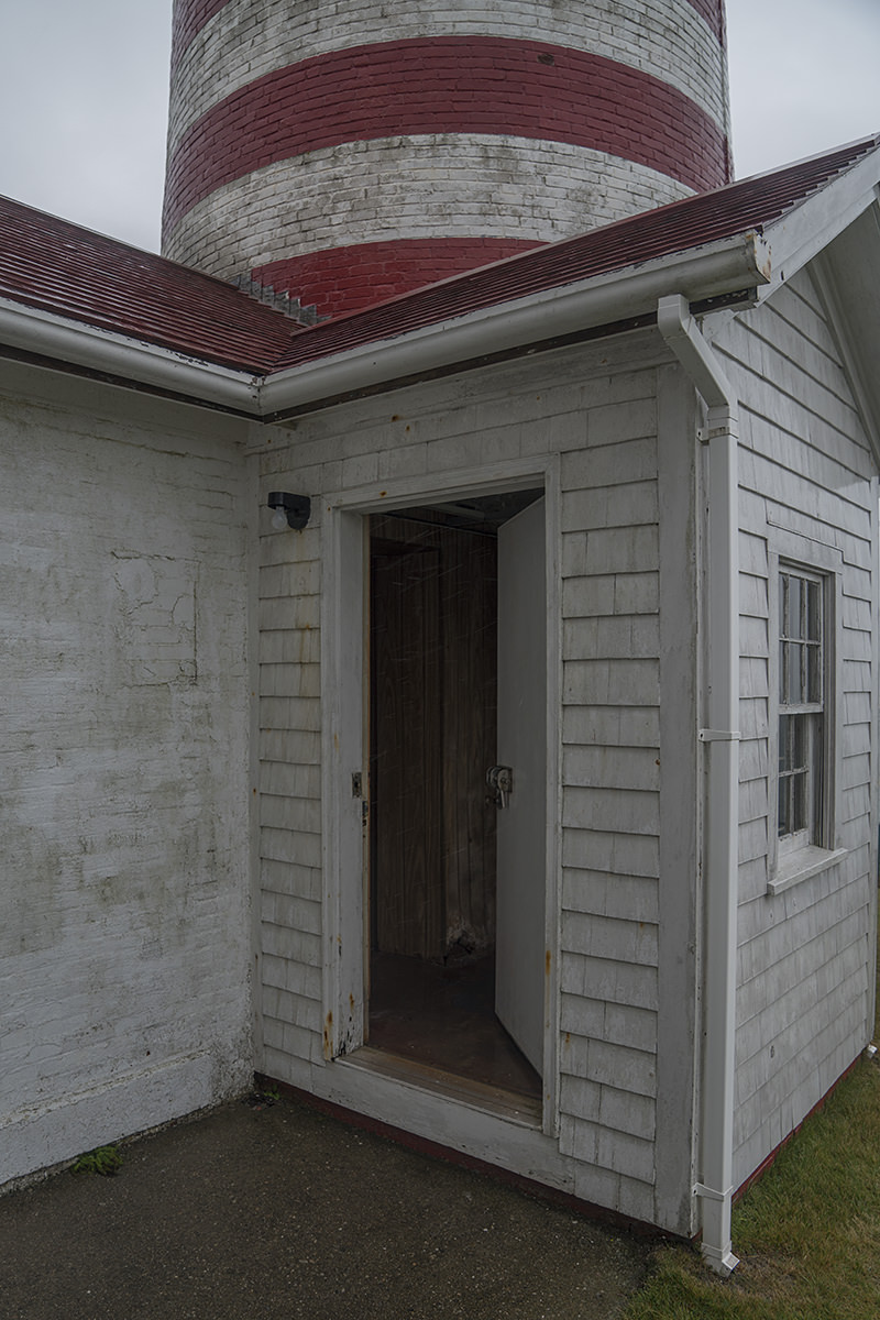
Interesting to note that the door to the lighthouse was open. I thought that maybe somebody was working there so I was going to shout "Hello?" but decided it'd be best not to scare anybody if they were up there. Which seemed doubtful because mine was the only car around. One thing was for sure... I was not going to go climbing up for a look when the lighthouse tower is not open to the public. Something tells me that's an invitation to getting shot...
I tried to photograph the ocean, which was not looking friendly at all, but the wind kept knocking me off balance. Only one photo really turned out (rain splotches and all). Alas it's not that interesting to look at...
With nothing else to do, I got back in my car and headed back down (up?) to Acadia. Guess my day was over.
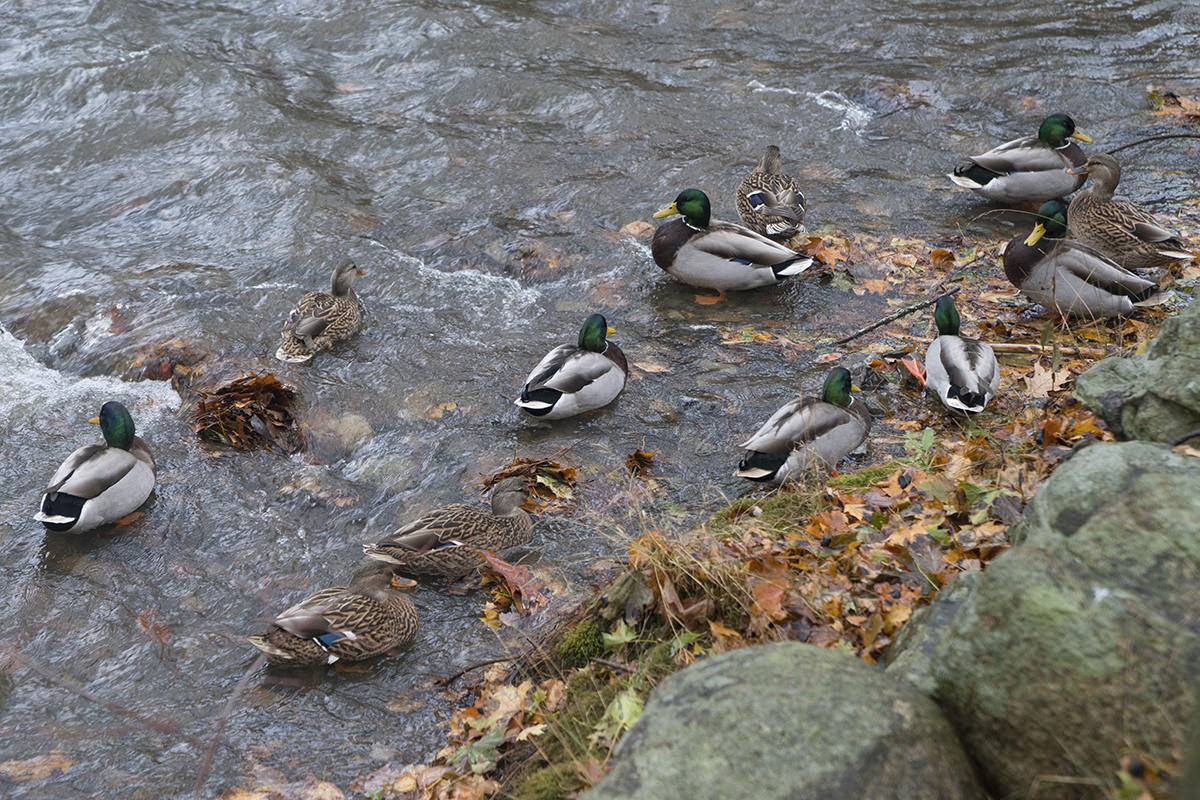
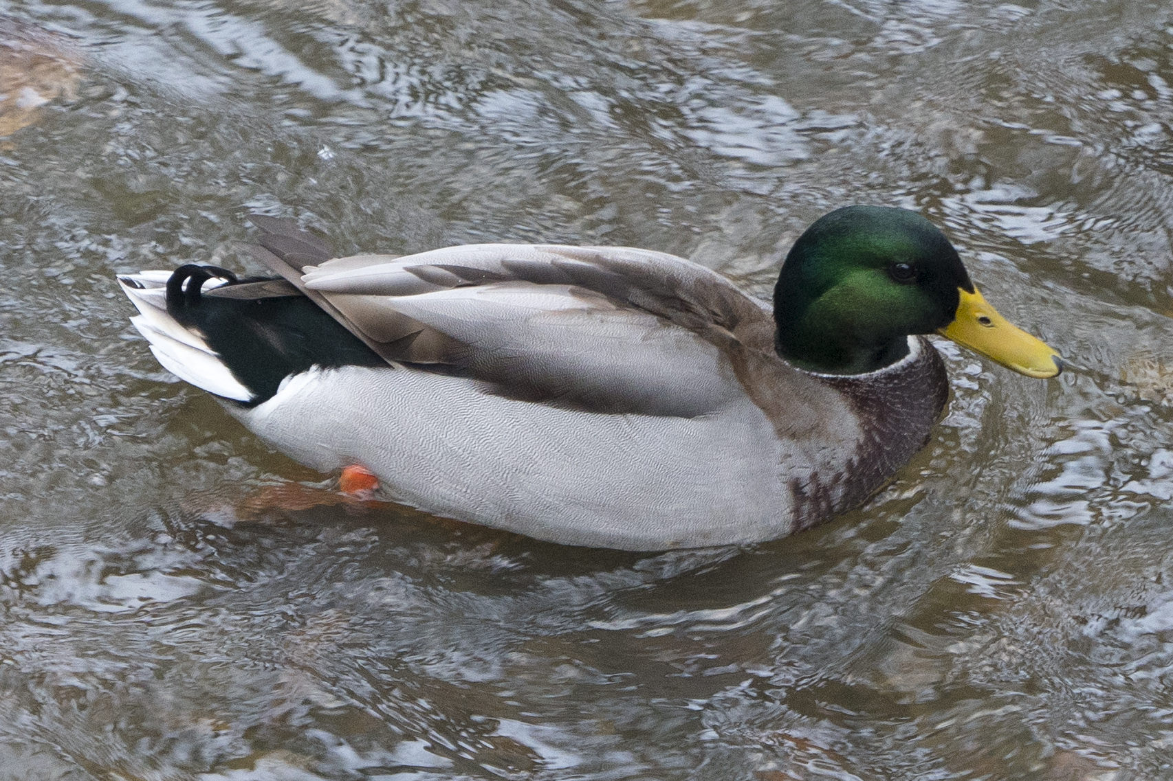
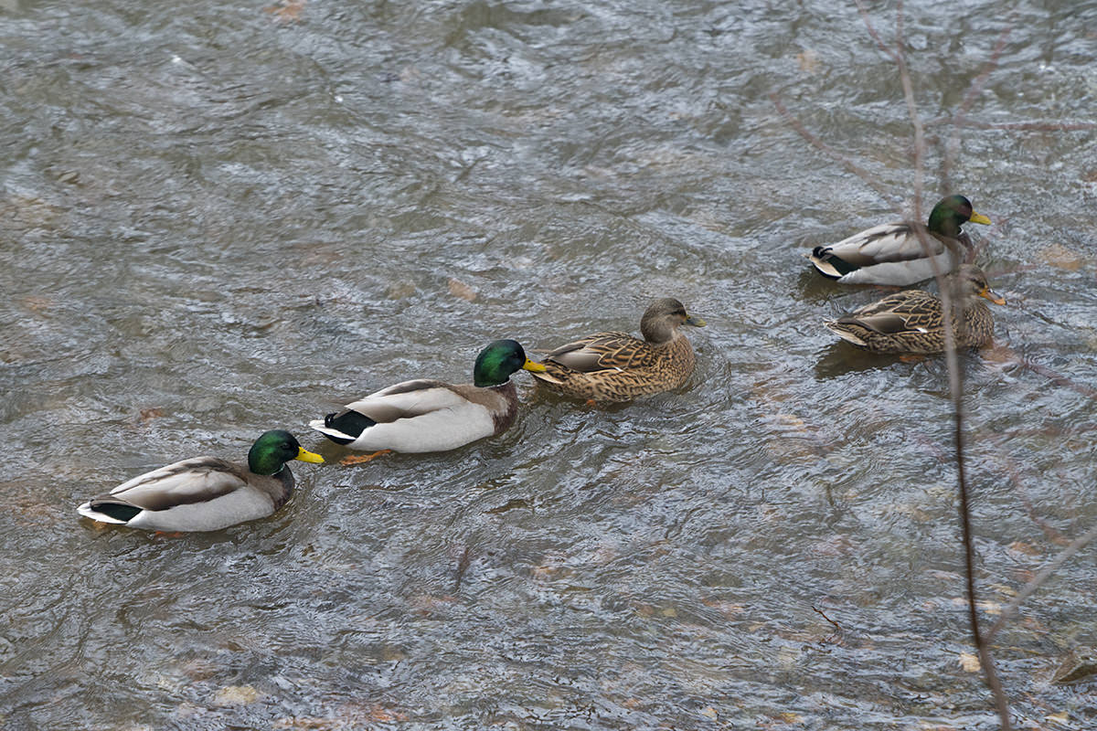
My room back in Bar Harbor overlooks a brook. A brook where ducks like to hang out at all hours. For the most part they're quiet, but every once in a while a fight will erupt and much quacking will ensue. When I got back, there were far more ducks than usual with far more quacking going on...
Annnnnd... the end.
I suppose now I should plan a trip to Northwest Angle, Minnesota so I can check off the Contintental US northernmost point. Then I need to take a hike to Cape Alava in my home state of Washington so I can check off the Continental US westernmost point. It seems the completist thing to do, doesn't it?
*People in Maine would never say they were going "up the coast" like this. To them, up is down because Downeast is up. I found this out when people at my work kept saying things like "You came down from Boston today or yesterday?" and "When are you headed back up to Boston?"
**Turns out these were probably not "gale force winds" after all because Wikipedia says that a "gale" is 39 to 54 mile-per-hour winds. Well, whatever. They were very strong winds, that's for sure.
 "Hey, you're half-way there!" I said.
"Ugh. Is it worth it?" he replied.
"You get to see a giant rock hanging over the edge of a cliff and a glorious view of Jordan Pond, so I'd say it's worth it." I said, trying to sound enthusiastic.
"Hmph. Okay..." he huffed, as he walked past.
Yesterday I shot everything on "Full Auto" because I was tired. Today I thought I'd get creative and use my own camera settings. It's a decision that would come back to bite me in the ass* but dems da breaks. Still. I did play around with HDR** a bit, so that was fun.
But before we get to all that... first a word about squirrels.
I love the little guys. They're industrious, clever, cute, and move like magic. And they're everywhere in Acadia. I took tons of photos of them all day long, which is easier said than done given how skittish they are and how quickly they move...
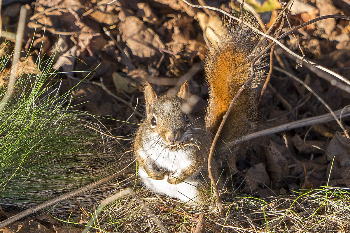
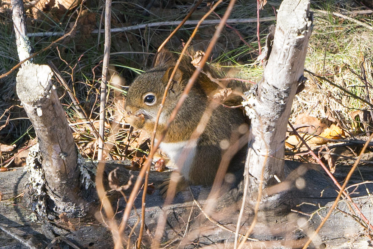
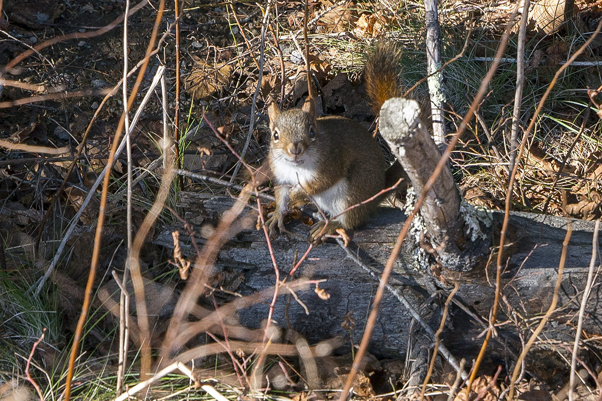
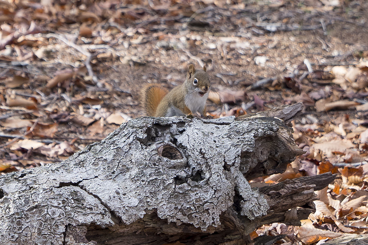
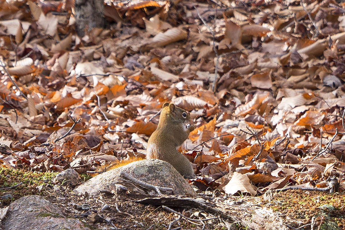
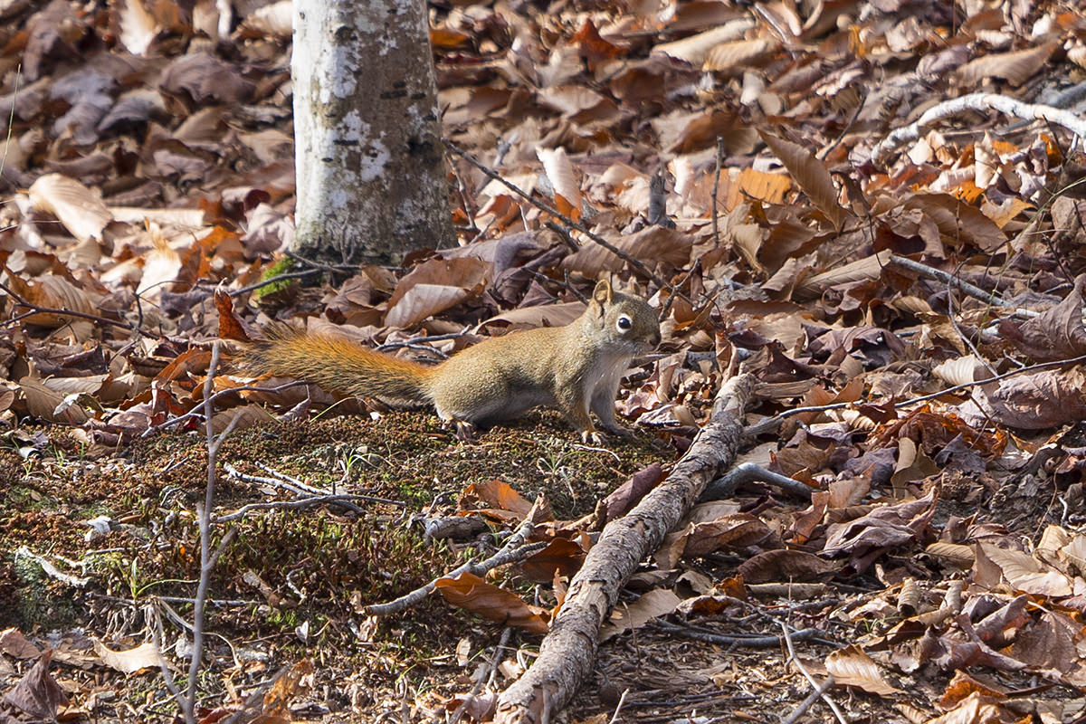
Needless to say, photographing squirrels through the underbrush is a manual-focus affair.
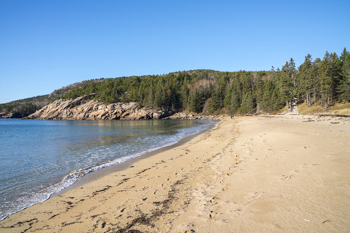
My first stop this morning was Sand Beach. You know that sand beaches are rare in Maine when they are inevitably called "Sand Beach." Sure enough, as advertised, there's sand...
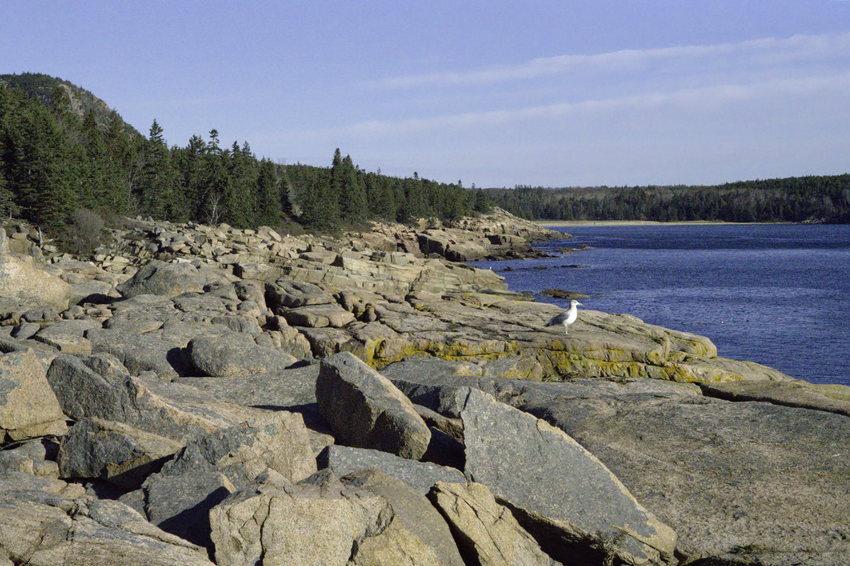
From shortly after Sand Beach there's a trail that wanders along the coast for two miles. I did a walk-drive kind of thing. Sure the rocky coast is pretty, but it looks much the same as the rest of Maine's coast, which I've seen a lot of. Occasionally there's a a small difference. Like a seagull wandering into the shot...
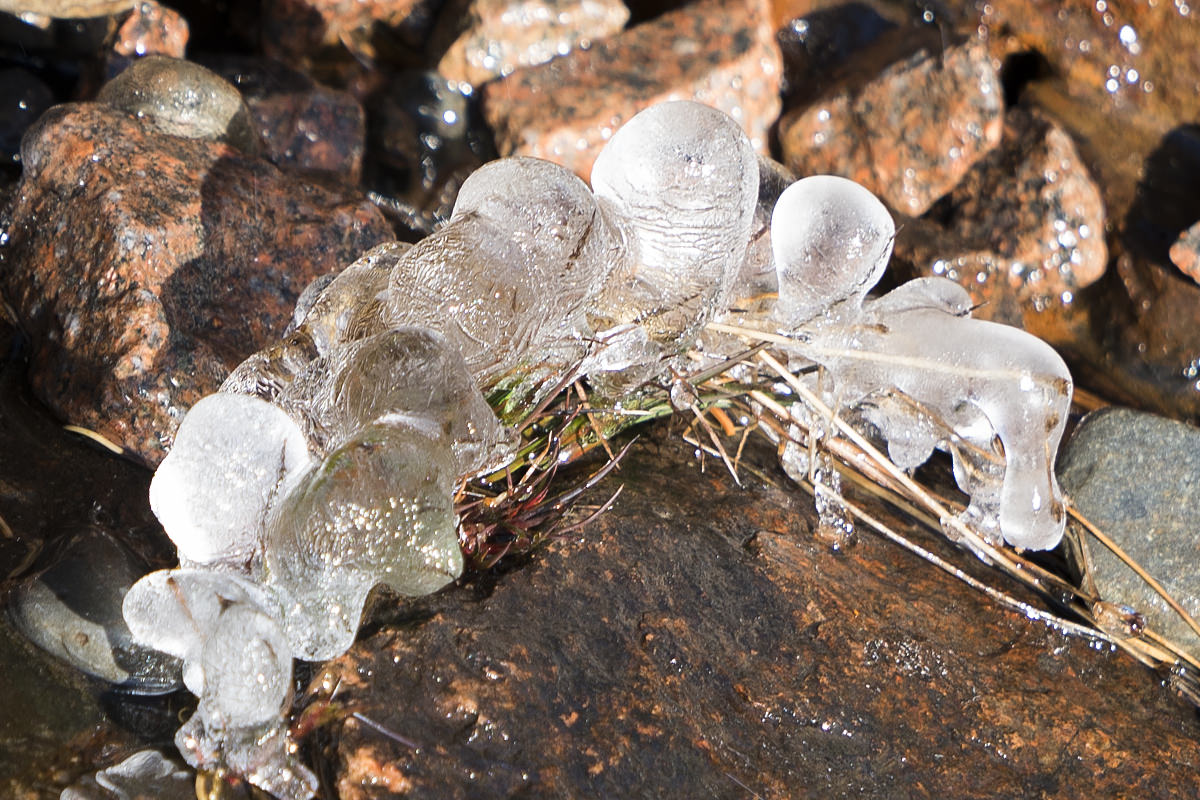
Another thing that was different? Something... I don't know what to call it. I was wandering along the rocks when I spotted what I thought was a tiara or some kind of jewelry bauble glinting in the sun...
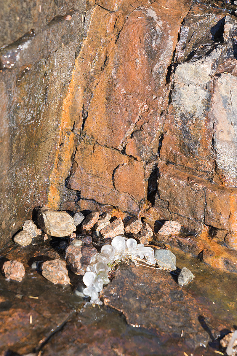
Turns out it was ice. Weird ice that had somehow formed to look like pearls! Crazy stuff I've never seen before...
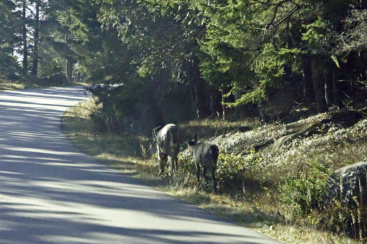
Another animal (other than squirrels) there's a lot of in Acadia right now? Deer. I know this because they kept bolting in front of my rental car. Not just once, but three times. I was driving 35mph (the speed limit) which is probably too fast given that these creatures would have had to have been scraped off my grill if my reflexes were any slower...
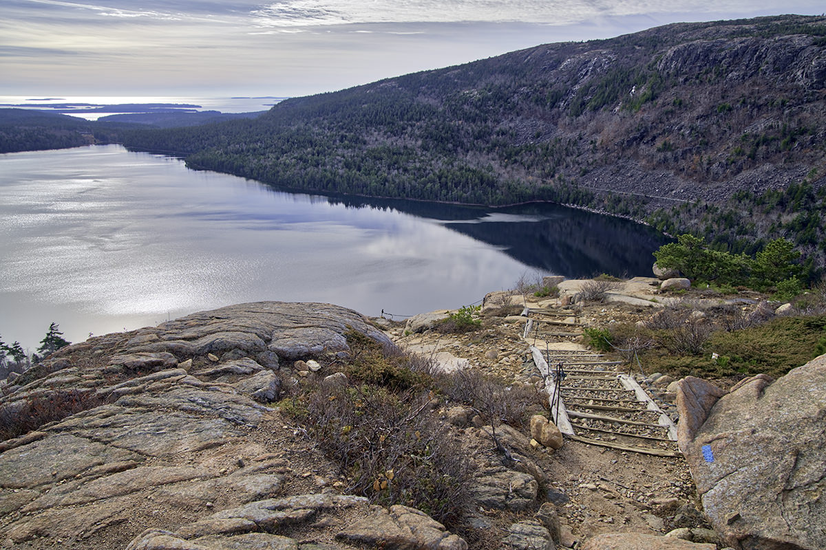
My next stop was Jordan Pond. It's home of the Jordan Pond Restaurant, which is famous for popovers that are apparently more addictive than cocaine. I wouldn't know, because the restaurant was closed for the season (like most things in Acadia just now). The pond, however, was open...
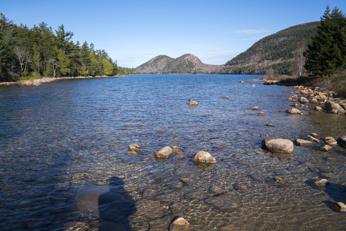
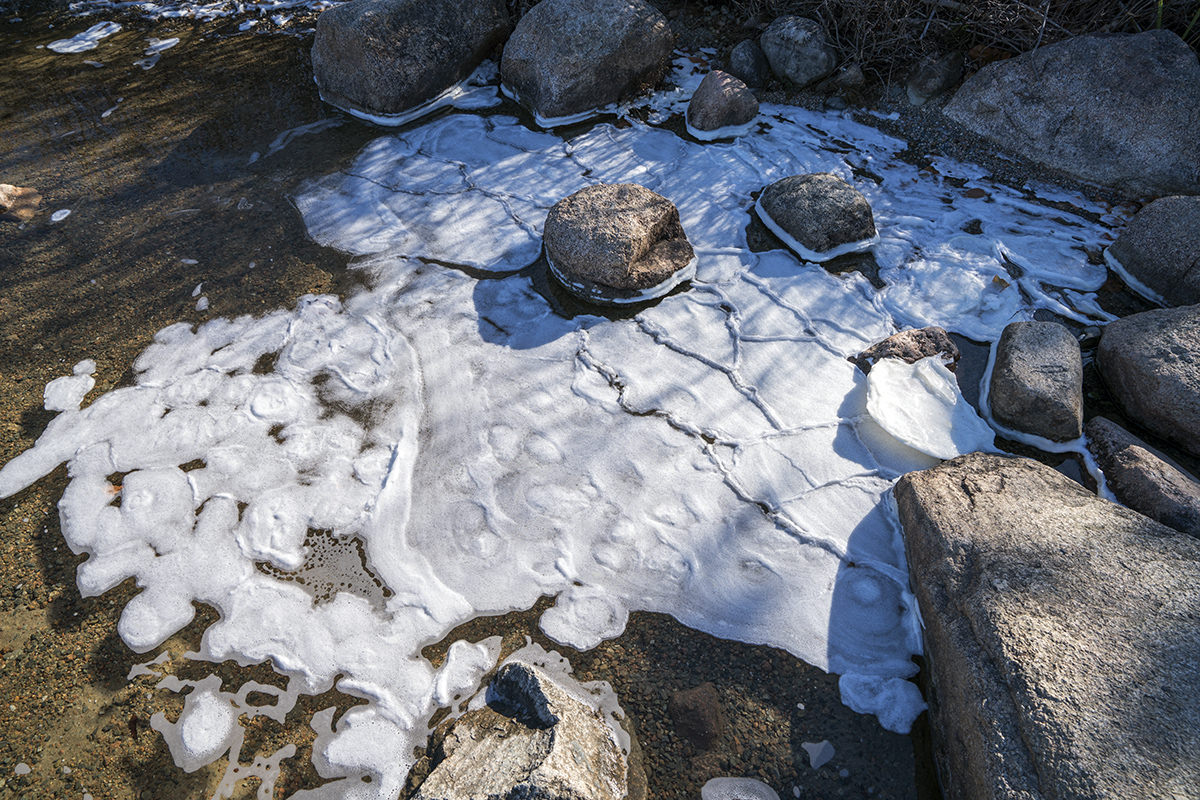
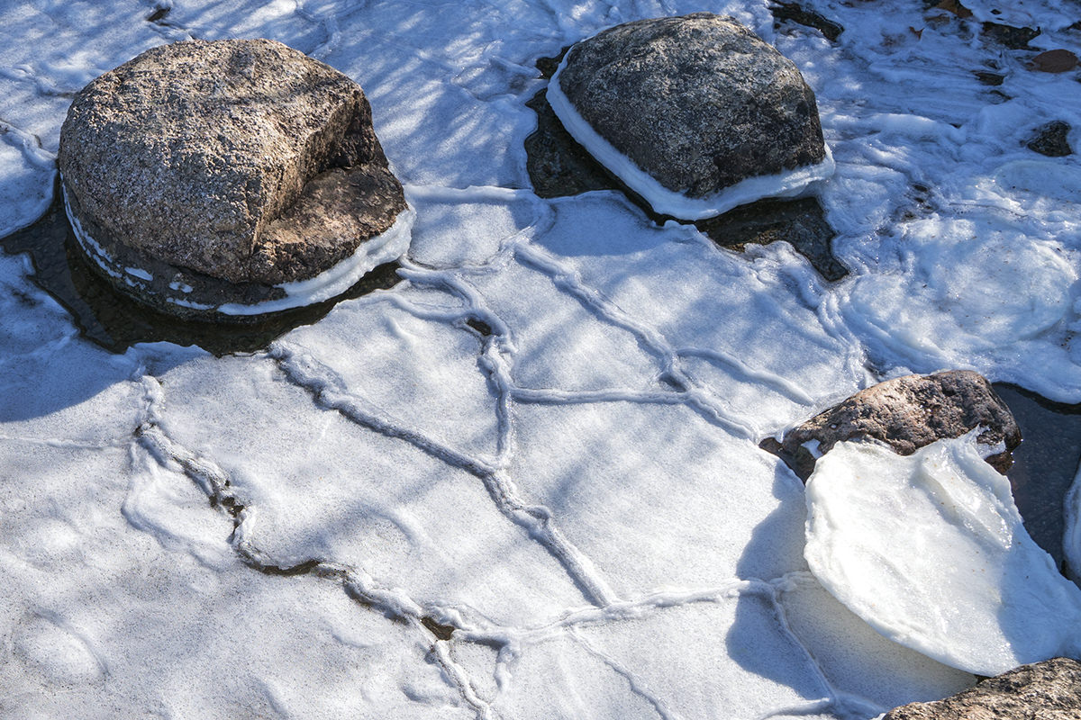
Jordan Pond is so pure and clear that it's used as a drinking water source. Which means you can't swim in it or have pets near it. The sun was not at an optimal angle for me to photograph the clarity, but I gave it my best shot...
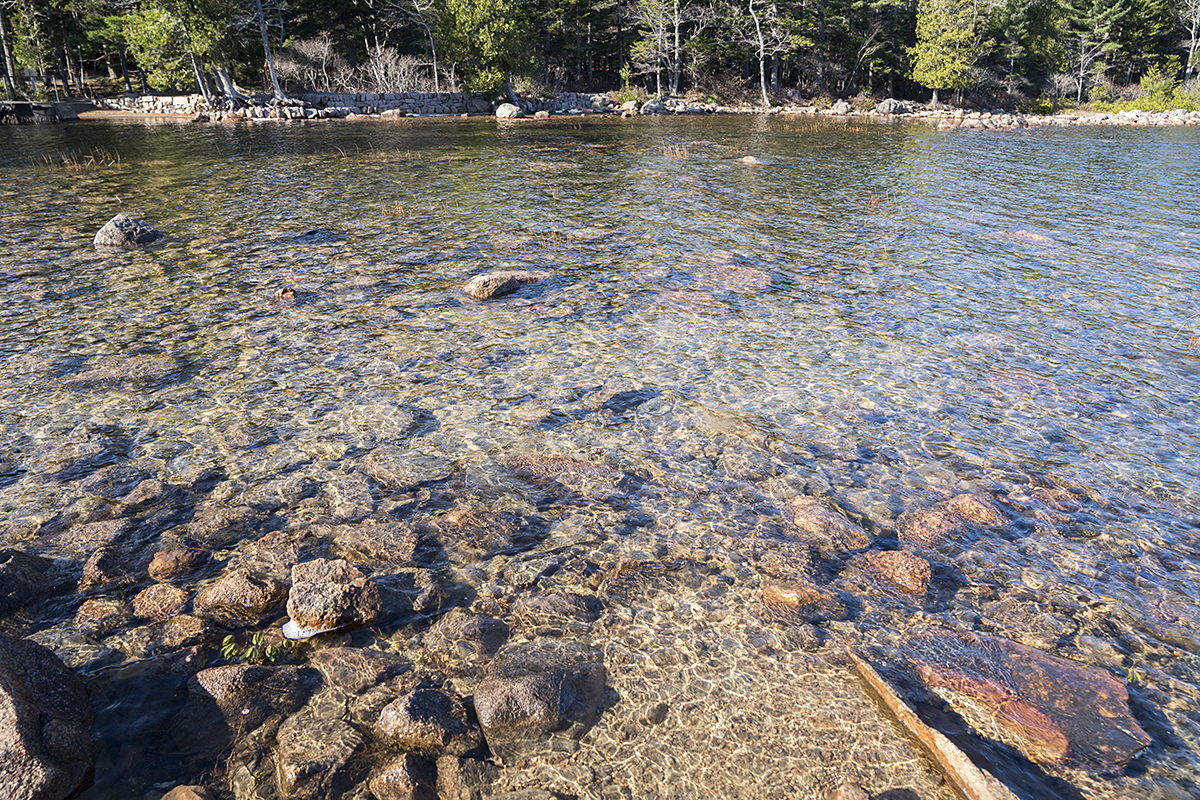
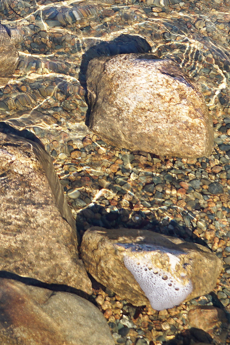
An interesting feature of Jordan Pond is the sea-foam (pond-foam?) that had frozen at the water's edge...
After goofing around at the pond photographing a lot of squirrels, I headed to the Big Event of the day... a hike up the Bubble Mountains.
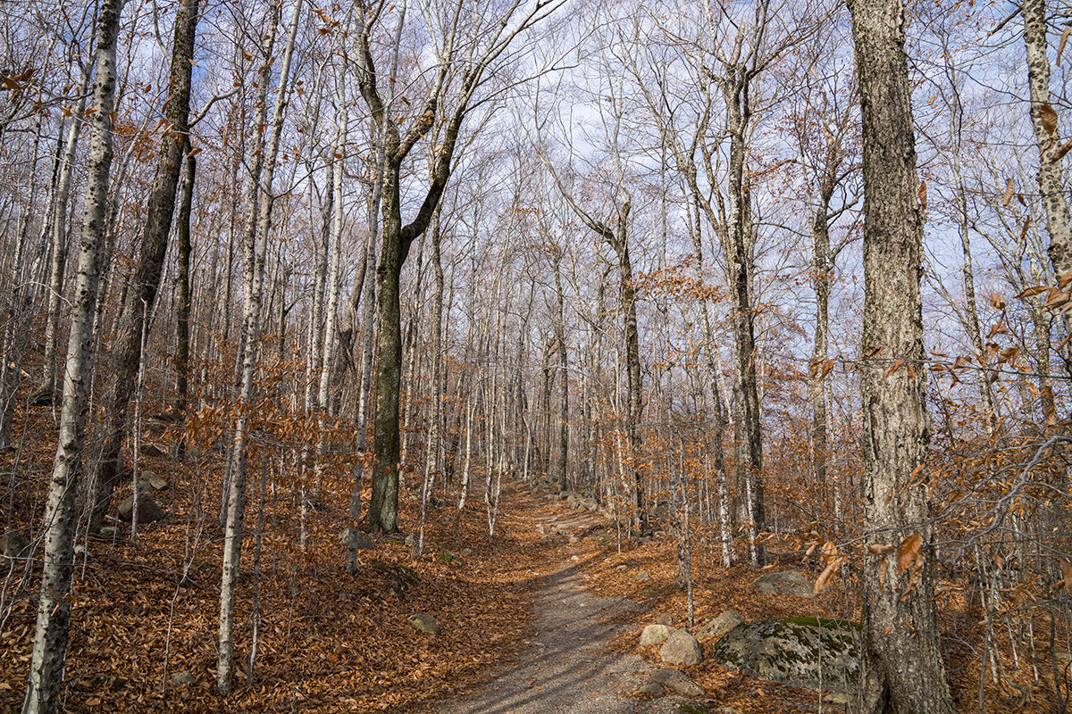
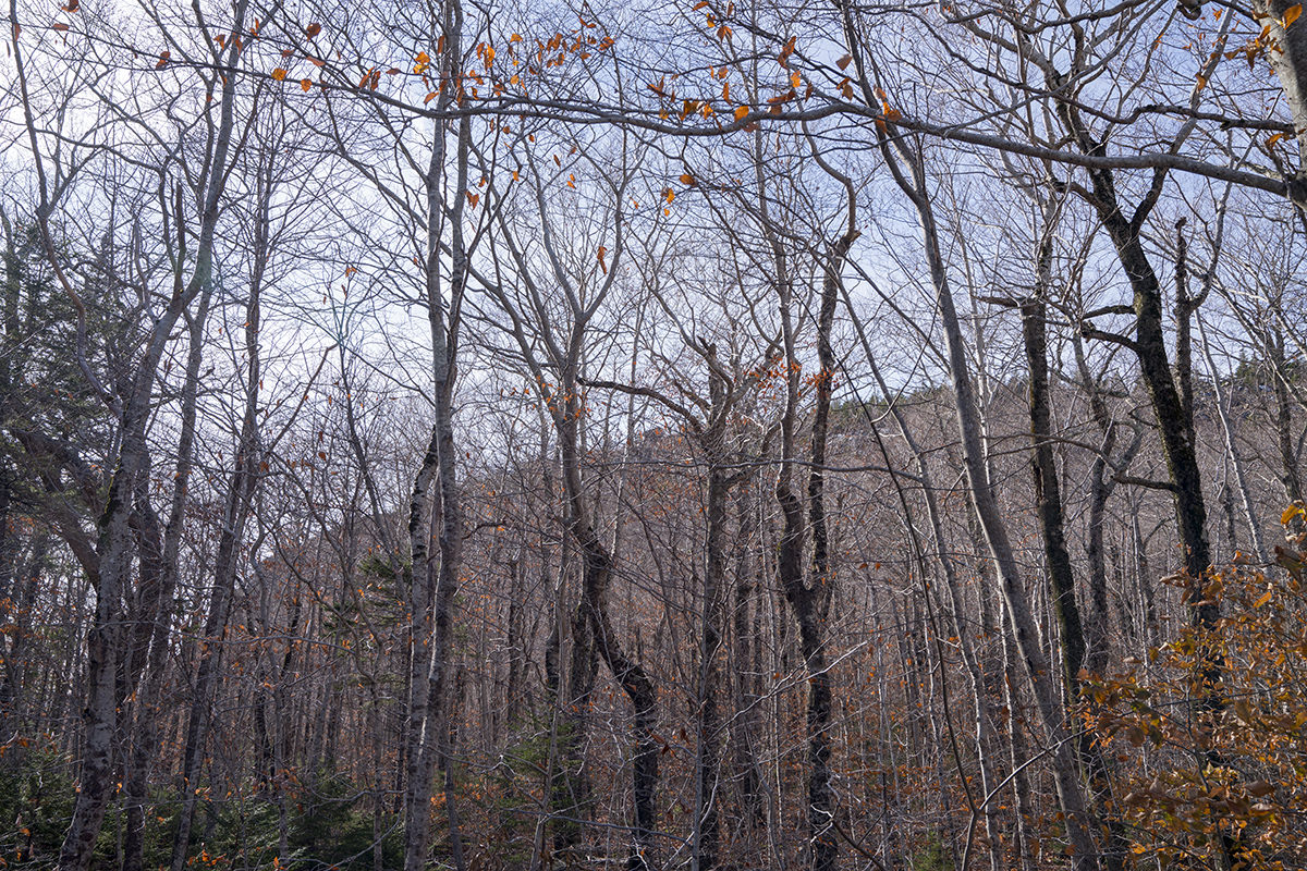
If you scroll back up to the first photo of Jordan Pond I posted, you'll see two twin "mountains" in the background. Those are the "Bubble Mountains" and are easily hike-able. The trail is tricky in parts and has a bit of a rise, but pretty simple overall. The trees along the way had lost all their leaves but were still pretty to look at. I can't fathom how beautiful they must be in the Fall...
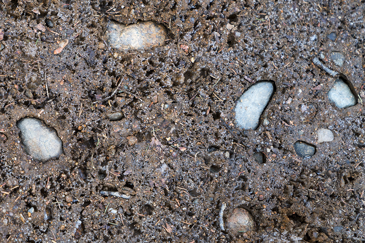
The trail itself was interesting for two reasons. First, water forms around the rocks embedded in the trail, which then freezes, expands, pushes the dirt away, then melts. Leaving all the rocks in little holes...
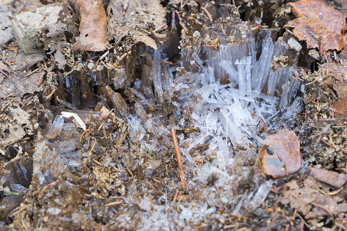
Second of all, water also freezes in crystalline shapes all along the trail. You see it everywhere, and it's really cool to look at...
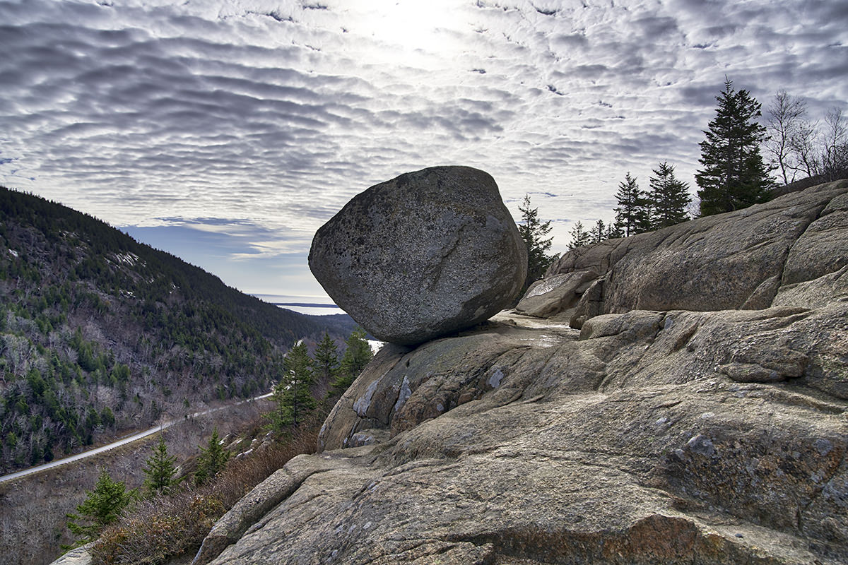
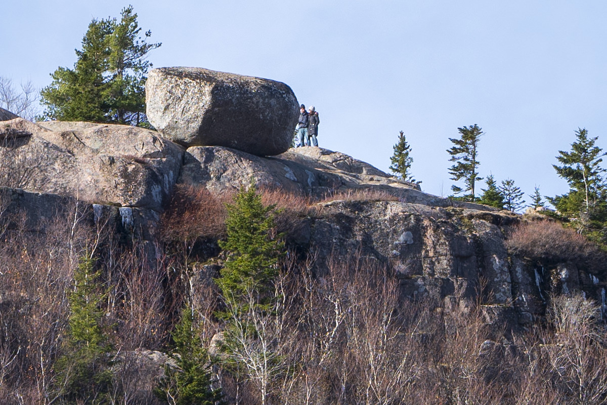
I decided to hike the "South Bubble Mountain" because it has a feature that's entirely too cool. "Bubble Rock" (also known as "Balanced Rock"). When you cross the crest of the trail, the rock isn't that impressive. Looks kind of like a massive baked potato...
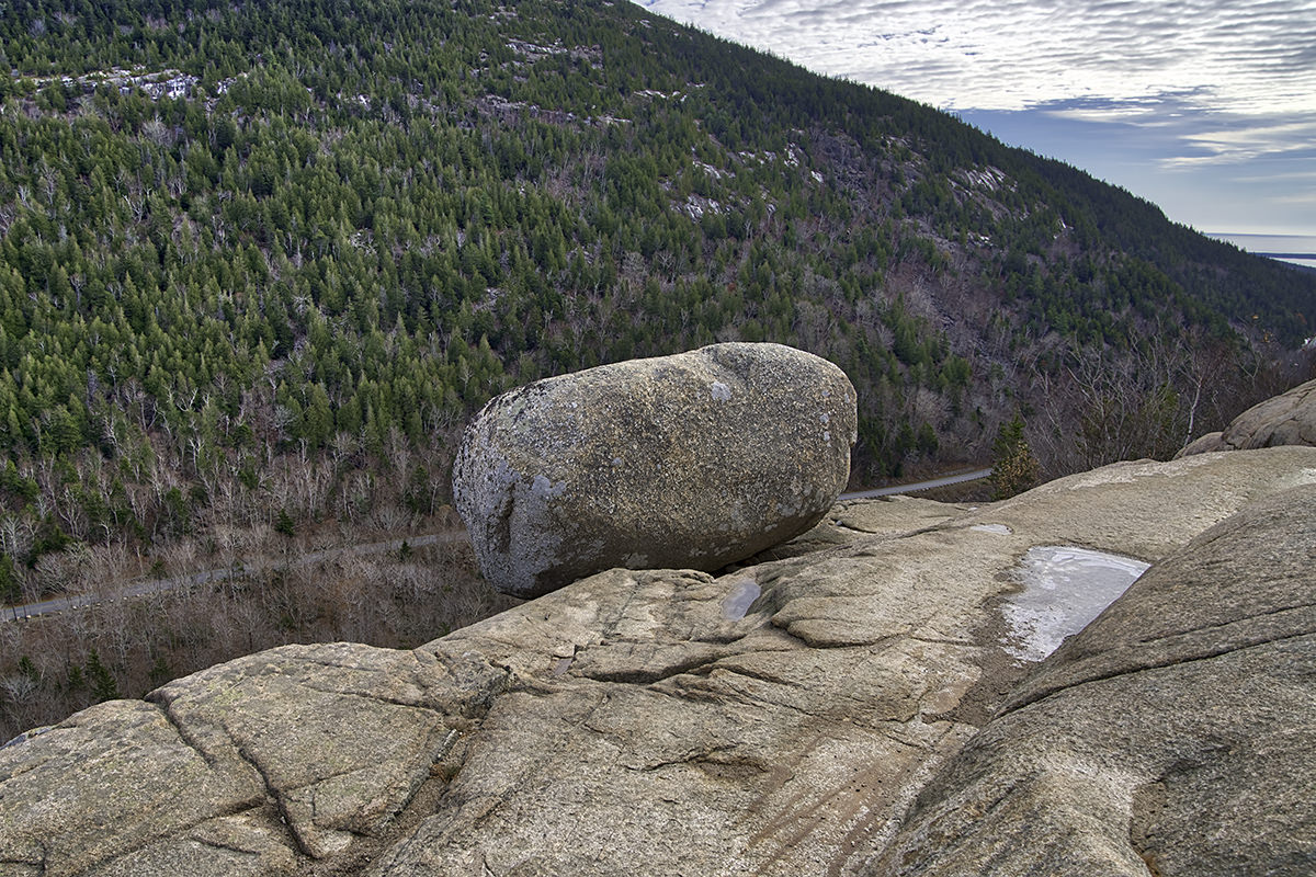
But then you climb around to look at it from a different angle, and it's a different story...
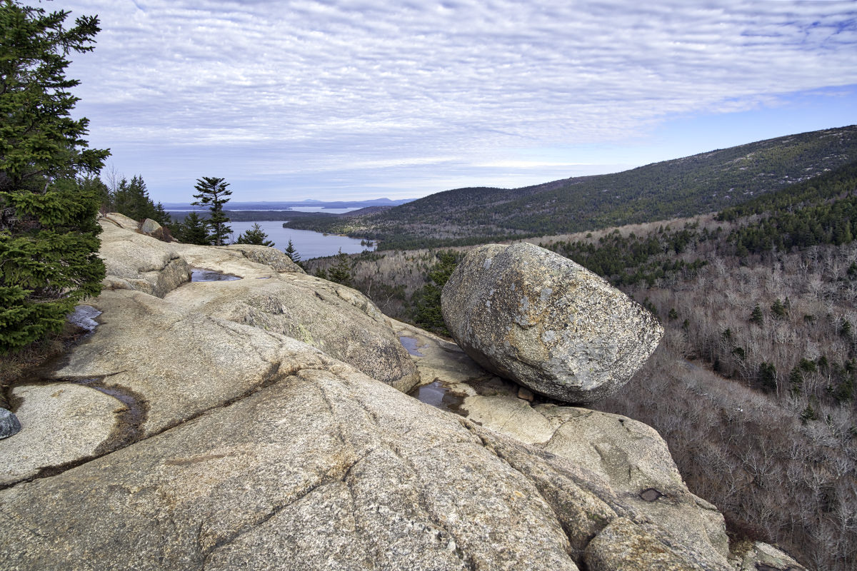
Uh. Wow. Definitely worth setting up an HDR photo so I could shoot into the sun and still see it...
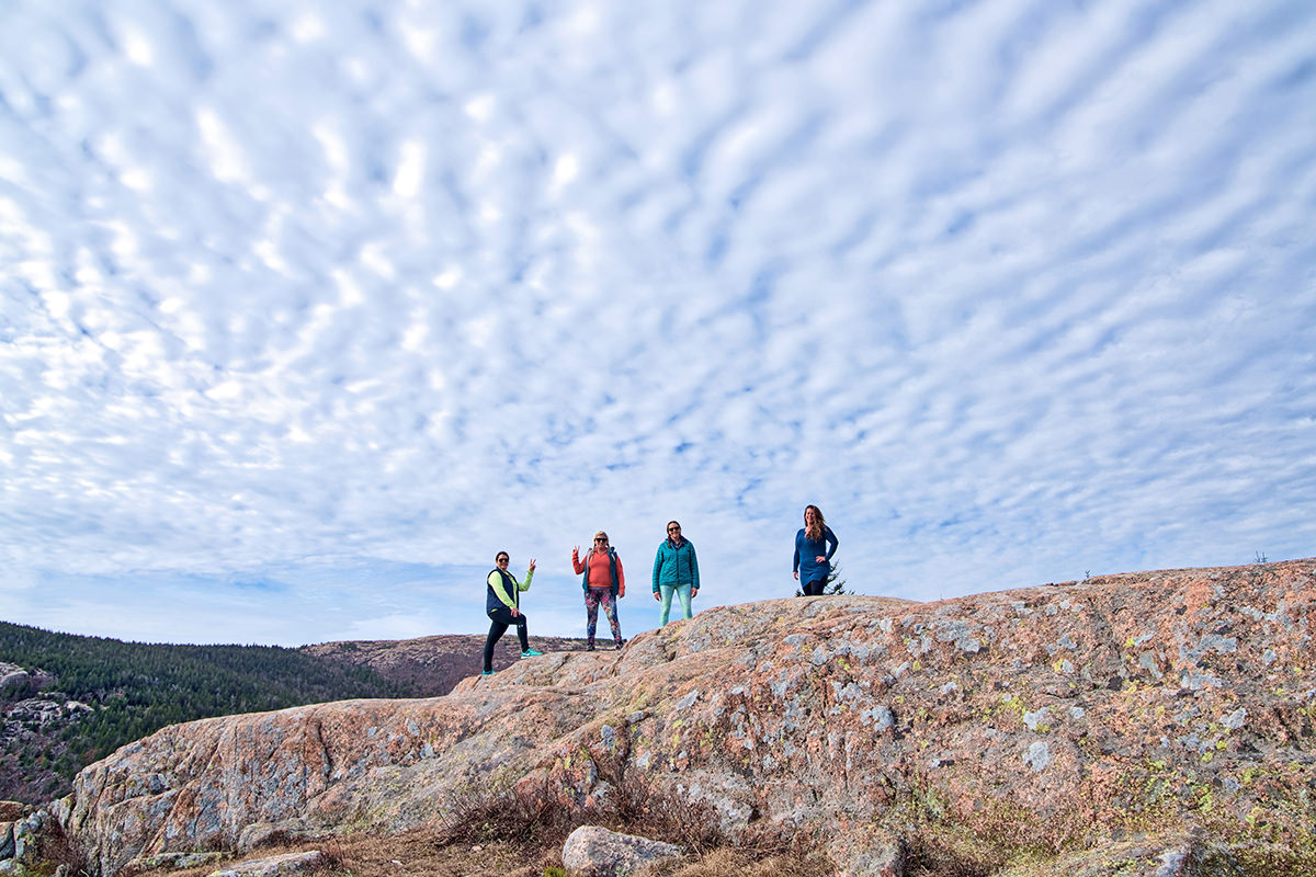
If you keep going past Bubble Rock, there's a great view back down to Jordan Pond. That's where I met the ladies from the blog Love Maine Adventures who were soaking up the view and taking photos. They asked me to take a photo of them with their camera, which I did. Then I decided since I was shooting HDR that I would ask to experiment with them and shoot some "people HDR" photos, which are tricky because everybody has to stand perfectly still. They were nice enough to grant my crazy request and did a great job...
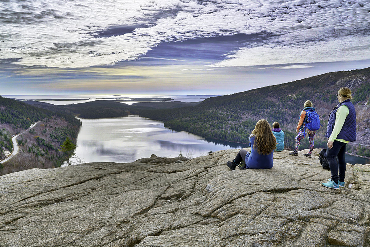
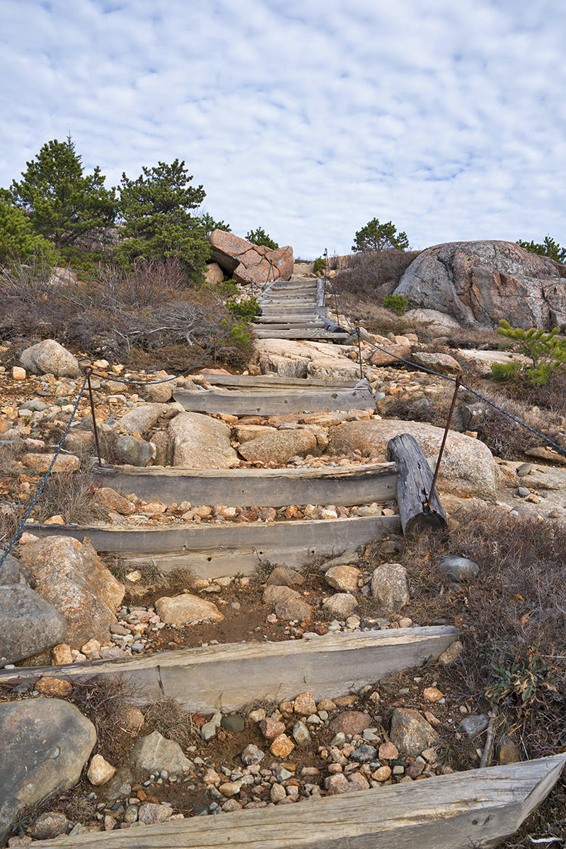
I was going to call it a day because the trail down to the Jordan Pond overlook had CAUTION signs on it. But Love Maine Adventures encouraged me to risk my life and give it a try because they said it really wasn't that dangerous. Turns out they were right, it wasn't. And the view was great...
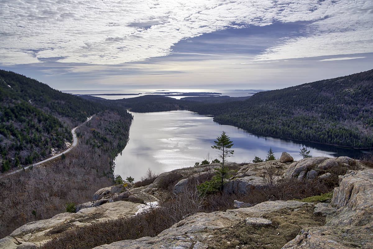
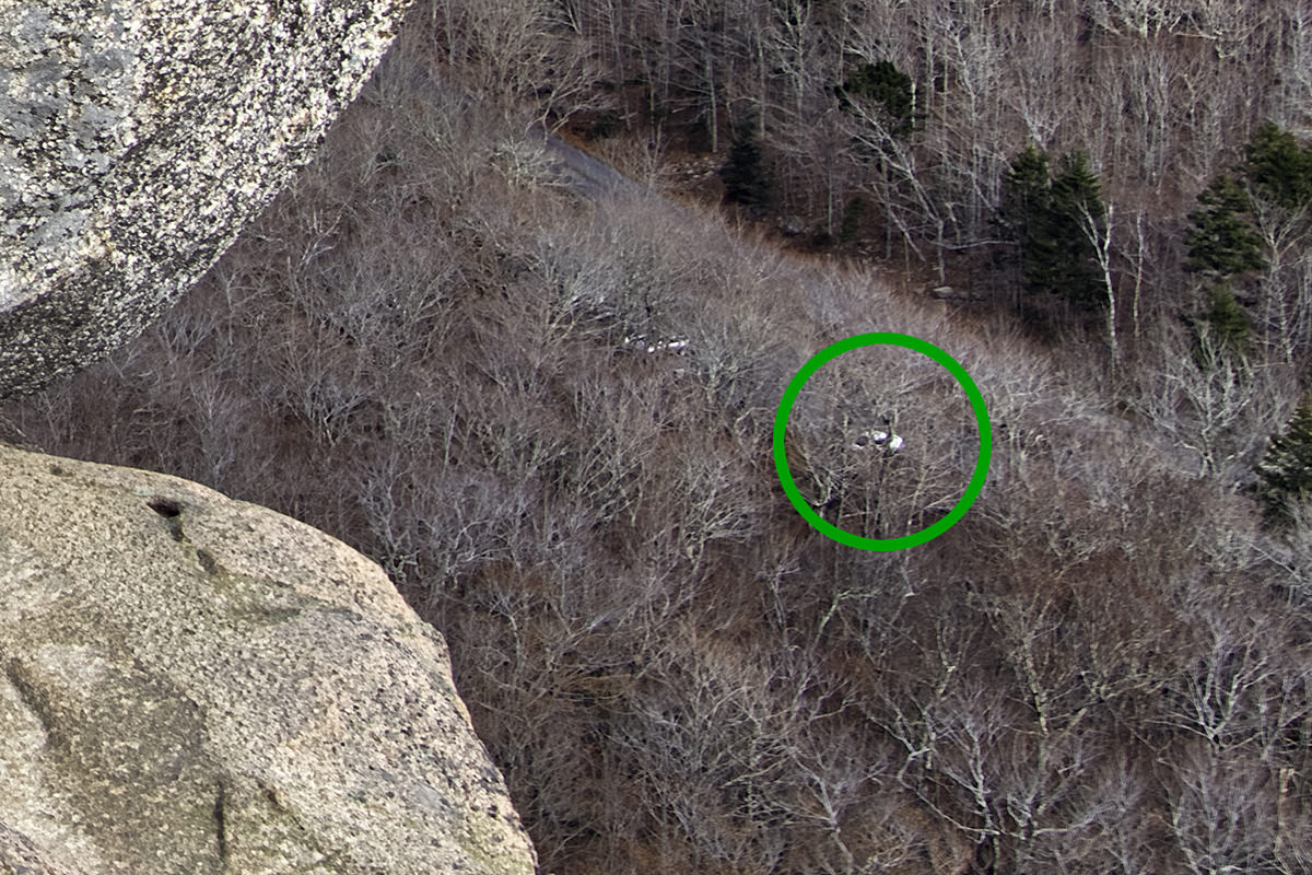
As I headed back down the mountain, I took once last look at Bubble Rock as I passed... and saw something strange. Right beneath the rock was my rental car all the way down in the parking lot! If you scroll back up to the second Bubble Rock photo I posted, you can actually see it there... I just hadn't noticed! Here's that same photo, but zoomed in...
When I got back down to my car, I looked back up and took a reverse-angle shot. You can just make out Bubble Rock through the trees. It's smack-dab in the middle of this shot...
Curious to see if I could see Bubble Rock around the trees, I hopped in my car to backtrack so I could take a look. Sure enough, when I zoom in on maximum...
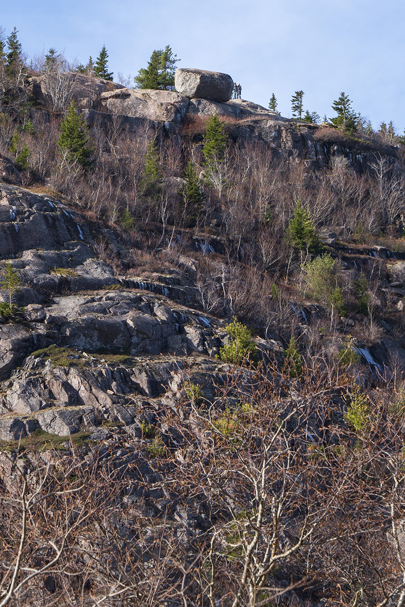
And, hey... if you zoom in even further, there's people there!
And thus ended my second day in Acadia. Time for a nap!
*The last time I used my camera, it was so I could photograph the eclipse back in August. In order to do that, I had to cover the lens with a piece of plastic that blocks out much of the light, then shoot at an ISO of 64,000. In a rookie mistake, I never reset my camera, and I didn't notice until I was half-way through my adventures today. Luckily, I shot some of the photos on "Full Auto," because a nice chunk of the photos from today where I tried to get creative were ruined because they were shot at grainy 64,000 ISO. Keep that in mind as you pour through all the photos in this entry. There could have been a lot more of them!
**High Dynamic Range... a photo technique where you blend photos together so that bits that are too dark and bits that are too light are evened out. I talked about it here.
My work, which was supposed to start on Saturday was moved to Tuesday. So much for trying to catch an early flight home. Which is actually not such a terrible thing, because it gave me a chance to check another U.S. National Park off my list... Acadia*.
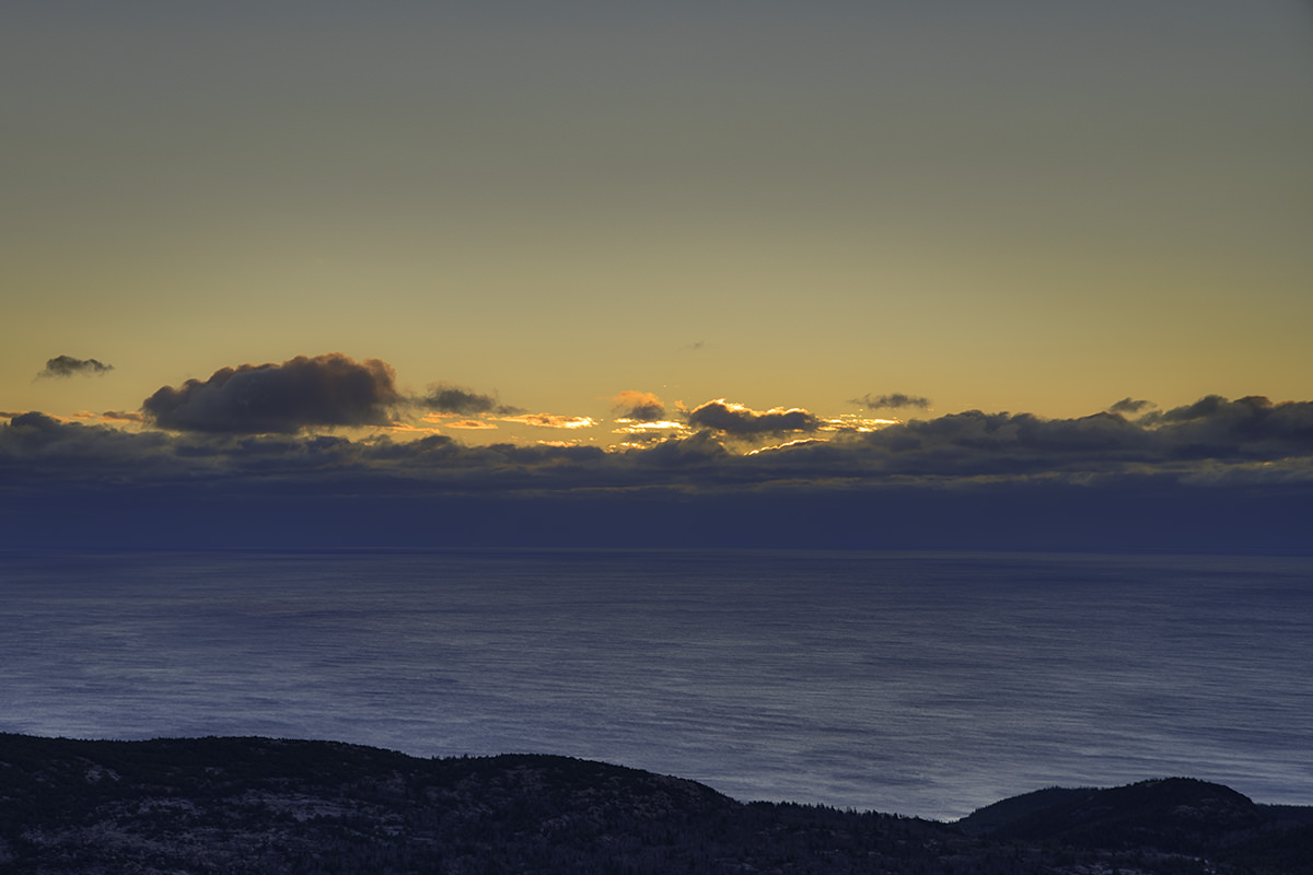
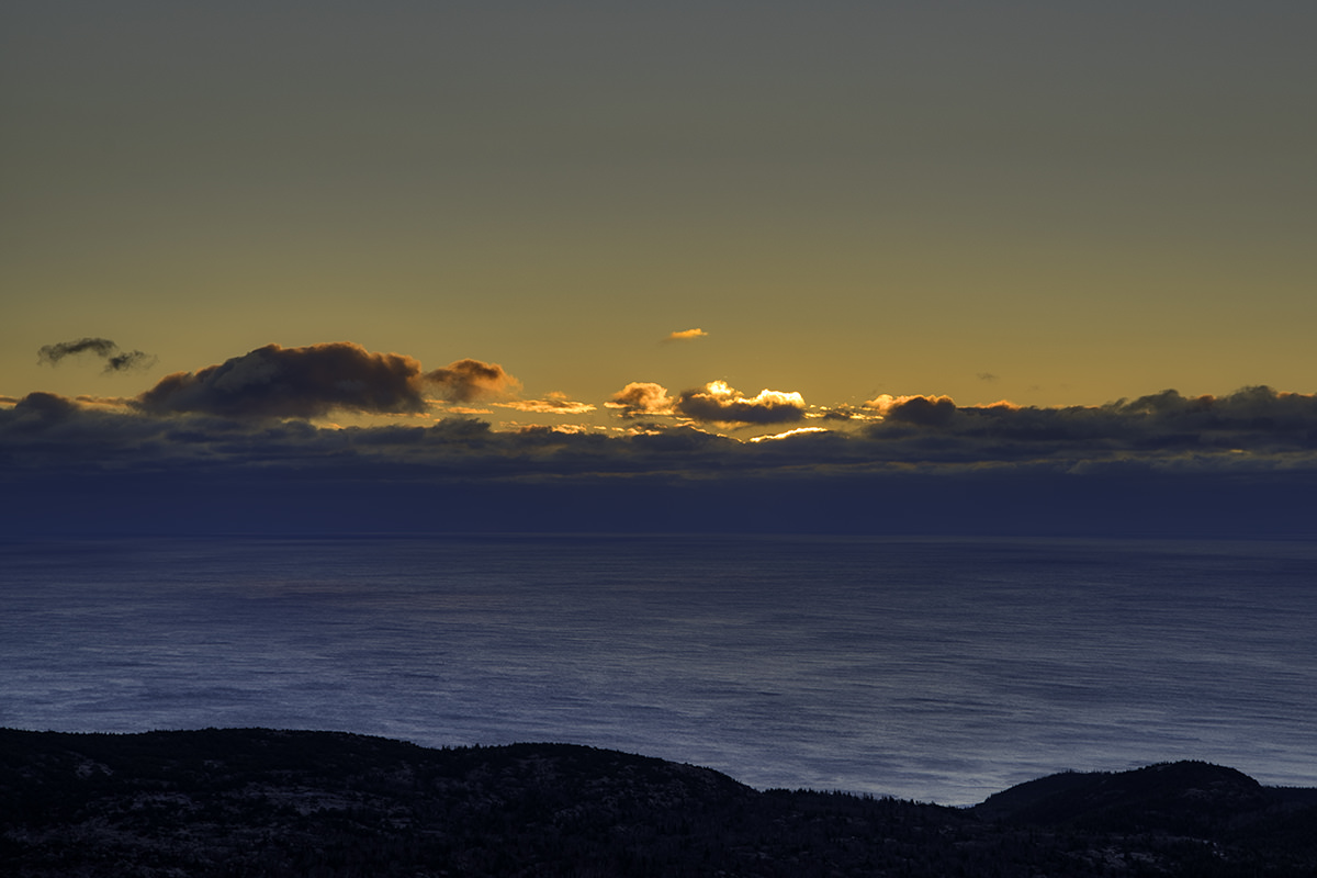
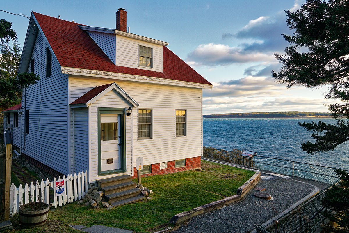
I wasn't able to leave Portland until 11:00am so I didn't make it to Bar Harbor until 2:00pm... three hours later. It's a boring but easy drive that goes by in a 70mph blur. Once I got to the park and checked into my super-cheap lodging (it is off-off season here now, so everything is either closed or cheap) I only had two hours of daylight left so I made a run for the Bass Harbor Head Light (or "lighthouse" to non-natives).
So far as lighthouses go, it's not a very impressive one. But it's at a killer location.
I decided to bypass the lighthouse keeper's quarters and head down to the shore before the sun set. A very rocky beach is not something you want to be navigating in the dark...
I passed this poor tree which has seen better days. He fell over and cracked in two over another equally unlucky tree...
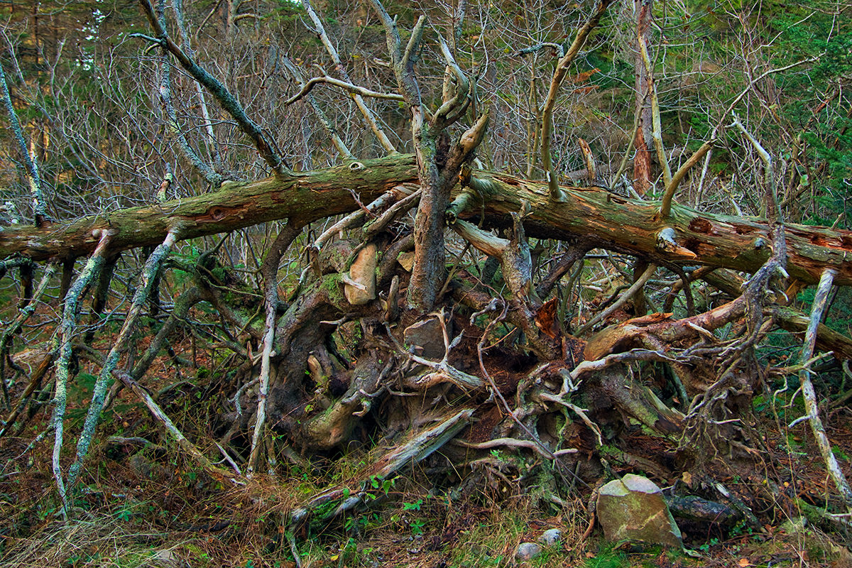
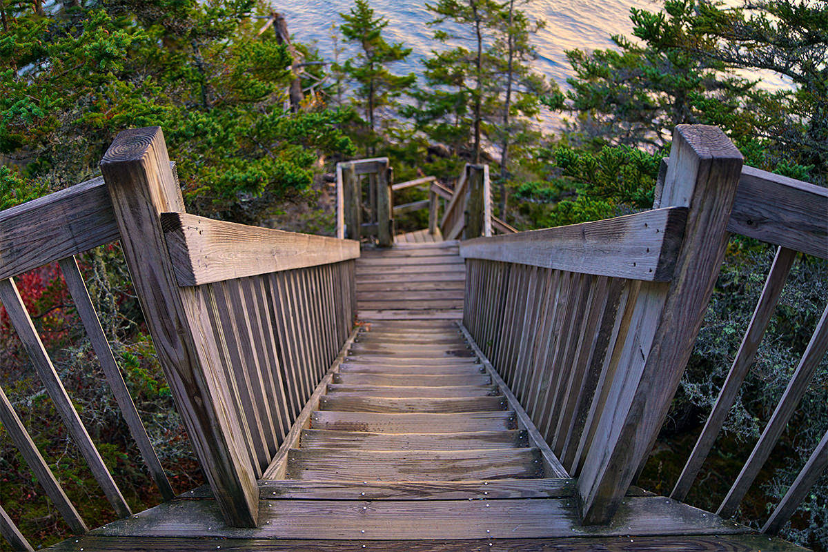
The area is kind of like a real-life game of Myst, with cool wooden stairs leading down the cliffside...
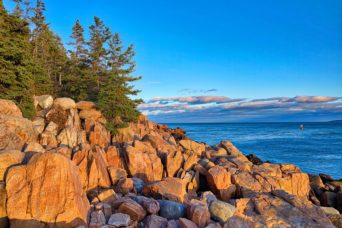
Good thing I wore my hiking boots. The rocks would be a lot tougher to climb over in tennis shoes. That being said, they sure are some beautiful rocks with the fading sun kissing them...
On the right-hand side there you can spot a buoy bobbing in the water. It has a bell on it that dings softly as the wind blows. This adds a kind of nice atmosphere to the whole scene.
And then there she is... the Bass Harbor Head Light...
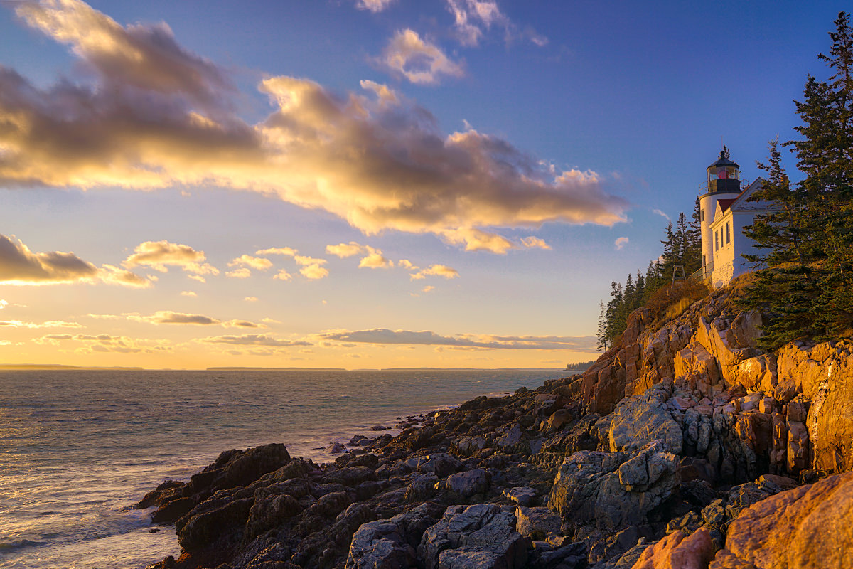
After goofing around the rocks for a while, I made my way back up and around the keeper's quarters to get up close and personal with the actual lighthouse. As I said, it's not particularly impressive, so far as Maine lighthouses go...
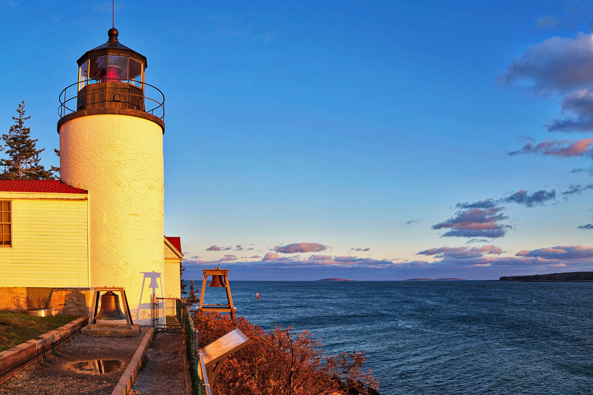
And yet... such a pretty location...
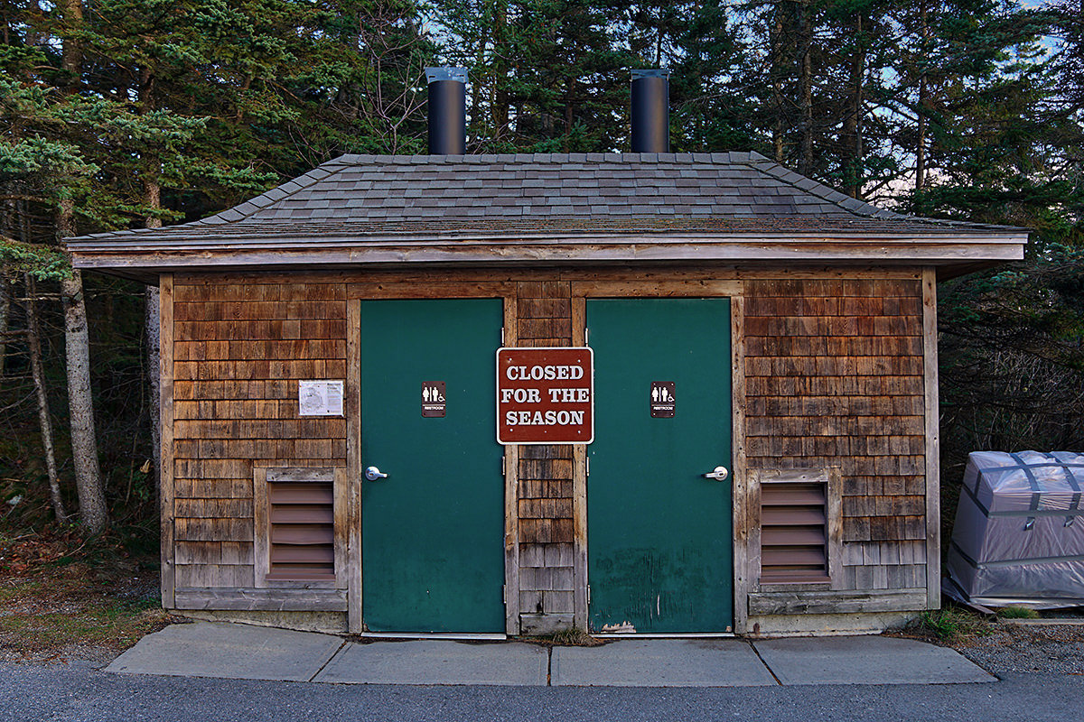
Unless you need to use the bathroom...
Pretty high on my bucket list is to come back to Acadia when the leaves are changing. If the trees are this pretty without them, they must be amazing in the Fall...
The drive back to my hotel was replete with quaint photo opportunities of coastal Maine living. I could only nab one of them before the sun was gone...
Not bad for my first two hours in the park!
Hopefully the weather tomorrow is as accommodating (and rain-free) as it was for me today.
*Acadia which, to my horror, I keep hearing pronounced outside of Maine as "Arrrcadia" for some reason. "Arcadia" was the Duran Duran splinter group. If you want to talk about one of the most beautiful parts of Maine, you have to drop the "R" when you say it.